K32A Verdigre, NE, USA - Earthquake Result Viewer
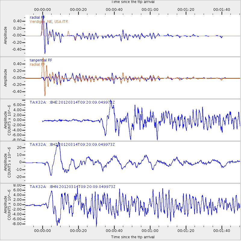
Earthquake location: Off East Coast Of Honshu, Japan
Earthquake latitude/longitude: 40.9/144.9
Earthquake time(UTC): 2012/03/14 (074) 09:08:35 GMT
Earthquake Depth: 12 km
Earthquake Magnitude: 6.7 MB, 6.9 MS, 6.9 MW, 7.0 MW
Earthquake Catalog/Contributor: WHDF/NEIC
Network: TA USArray Transportable Network (new EarthScope stations)
Station: K32A Verdigre, NE, USA
Lat/Lon: 42.66 N/97.97 W
Elevation: 512 m
Distance: 79.3 deg
Az: 41.942 deg
Baz: 316.609 deg
Ray Param: 0.049049955
Estimated Moho Depth: 18.25 km
Estimated Crust Vp/Vs: 1.84
Assumed Crust Vp: 6.498 km/s
Estimated Crust Vs: 3.536 km/s
Estimated Crust Poisson's Ratio: 0.29
Radial Match: 93.71616 %
Radial Bump: 400
Transverse Match: 76.23056 %
Transverse Bump: 400
SOD ConfigId: 440406
Insert Time: 2012-05-25 22:46:41.737 +0000
GWidth: 2.5
Max Bumps: 400
Tol: 0.001

Signal To Noise

ChannelStoNSTALTA
TA:K32A: :BHZ:20120314T09:20:09.049973Z46.4717566.2645445E-61.3480327E-7
TA:K32A: :BHN:20120314T09:20:09.049973Z13.2612321.8992251E-61.4321634E-7
TA:K32A: :BHE:20120314T09:20:09.049973Z8.3320781.5656906E-61.8791117E-7
Arrivals
Ps2.4 SECOND
PpPs7.7 SECOND
PsPs/PpSs10 SECOND