
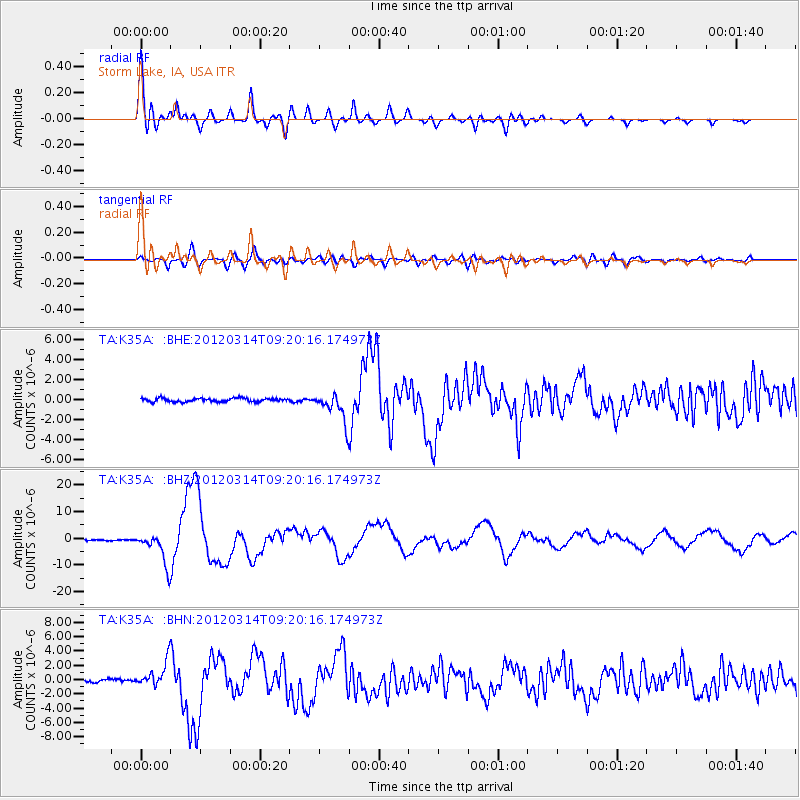
K35A Storm Lake, IA, USA - Earthquake Result Viewer
| ||||||||||||||||||
| ||||||||||||||||||
| ||||||||||||||||||
|
Signal To Noise
| Channel | StoN | STA | LTA |
| TA:K35A: :BHZ:20120314T09:20:16.174973Z | 31.779078 | 5.8924898E-6 | 1.8542042E-7 |
| TA:K35A: :BHN:20120314T09:20:16.174973Z | 8.783094 | 1.7589368E-6 | 2.0026393E-7 |
| TA:K35A: :BHE:20120314T09:20:16.174973Z | 8.186425 | 1.4530312E-6 | 1.7749277E-7 |
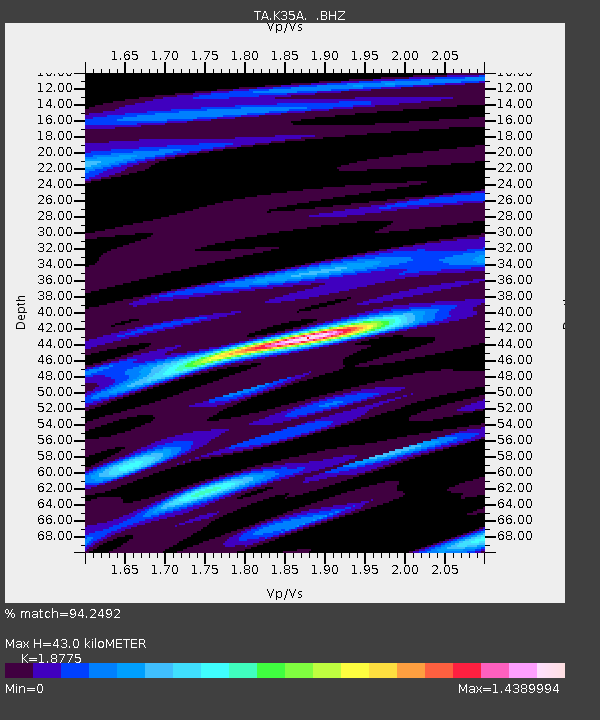
| Arrivals | |
| Ps | 5.9 SECOND |
| PpPs | 18 SECOND |
| PsPs/PpSs | 24 SECOND |

