J35A Milford, IA, USA - Earthquake Result Viewer
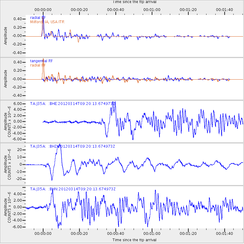
Earthquake location: Off East Coast Of Honshu, Japan
Earthquake latitude/longitude: 40.9/144.9
Earthquake time(UTC): 2012/03/14 (074) 09:08:35 GMT
Earthquake Depth: 12 km
Earthquake Magnitude: 6.7 MB, 6.9 MS, 6.9 MW, 7.0 MW
Earthquake Catalog/Contributor: WHDF/NEIC
Network: TA USArray Transportable Network (new EarthScope stations)
Station: J35A Milford, IA, USA
Lat/Lon: 43.37 N/95.21 W
Elevation: 457 m
Distance: 80.2 deg
Az: 39.941 deg
Baz: 318.132 deg
Ray Param: 0.048464917
Estimated Moho Depth: 19.0 km
Estimated Crust Vp/Vs: 2.00
Assumed Crust Vp: 6.53 km/s
Estimated Crust Vs: 3.269 km/s
Estimated Crust Poisson's Ratio: 0.33
Radial Match: 93.749146 %
Radial Bump: 400
Transverse Match: 78.3071 %
Transverse Bump: 400
SOD ConfigId: 440406
Insert Time: 2012-05-25 22:47:45.508 +0000
GWidth: 2.5
Max Bumps: 400
Tol: 0.001

Signal To Noise

ChannelStoNSTALTA
TA:J35A: :BHZ:20120314T09:20:13.674973Z50.273766.077959E-61.2089724E-7
TA:J35A: :BHN:20120314T09:20:13.674973Z7.83176661.2937888E-61.6519758E-7
TA:J35A: :BHE:20120314T09:20:13.674973Z8.1332551.3051465E-61.6047038E-7
Arrivals
Ps3.0 SECOND
PpPs8.5 SECOND
PsPs/PpSs11 SECOND