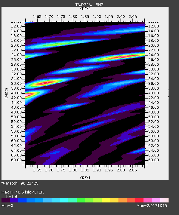
D34A Park Rapids, MN, USA - Earthquake Result Viewer

Earthquake location: Off East Coast Of Honshu, Japan
Earthquake latitude/longitude: 40.9/144.9
Earthquake time(UTC): 2012/03/14 (074) 09:08:35 GMT
Earthquake Depth: 12 km
Earthquake Magnitude: 6.7 MB, 6.9 MS, 6.9 MW, 7.0 MW
Earthquake Catalog/Contributor: WHDF/NEIC
Network: TA USArray Transportable Network (new EarthScope stations)
Station: D34A Park Rapids, MN, USA
Lat/Lon: 47.09 N/95.20 W
Elevation: 476 m
Distance: 77.4 deg
Az: 37.391 deg
Baz: 317.644 deg
Ray Param: 0.050342653
Estimated Moho Depth: 40.5 km
Estimated Crust Vp/Vs: 1.60
Assumed Crust Vp: 6.419 km/s
Estimated Crust Vs: 4.012 km/s
Estimated Crust Poisson's Ratio: 0.18
Radial Match: 90.22425 %
Radial Bump: 400
Transverse Match: 62.728172 %
Transverse Bump: 400
SOD ConfigId: 440406
Insert Time: 2012-05-25 22:50:43.622 +0000
GWidth: 2.5
Max Bumps: 400
Tol: 0.001

Signal To Noise

ChannelStoNSTALTA
TA:D34A: :BHZ:20120314T09:19:58.574998Z69.9967656.08035E-68.686615E-8
TA:D34A: :BHN:20120314T09:19:58.574998Z8.4812341.8728454E-62.208223E-7
TA:D34A: :BHE:20120314T09:19:58.574998Z9.96672251.6502531E-61.6557631E-7
Arrivals
Ps3.9 SECOND
PpPs16 SECOND
PsPs/PpSs20 SECOND