C06D Leavenworth, WQ, USA - Earthquake Result Viewer
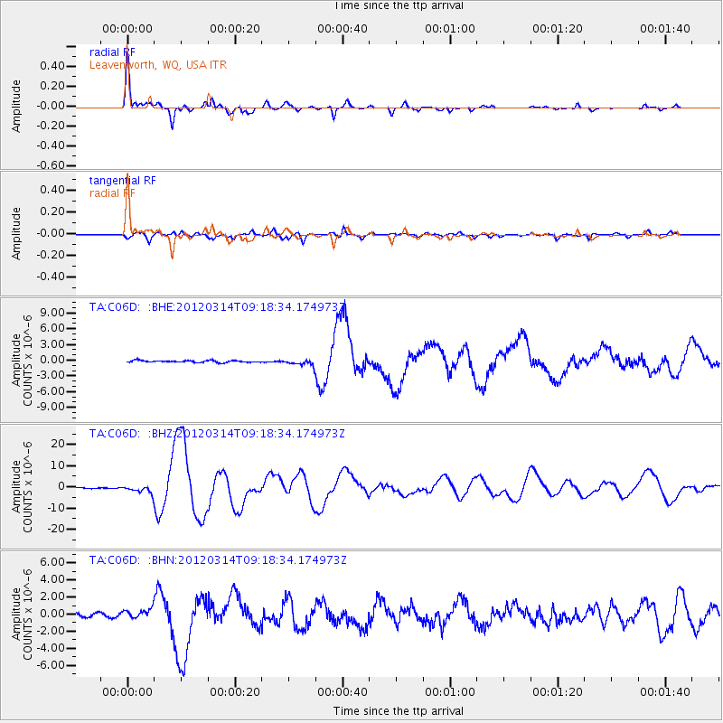
Earthquake location: Off East Coast Of Honshu, Japan
Earthquake latitude/longitude: 40.9/144.9
Earthquake time(UTC): 2012/03/14 (074) 09:08:35 GMT
Earthquake Depth: 12 km
Earthquake Magnitude: 6.7 MB, 6.9 MS, 6.9 MW, 7.0 MW
Earthquake Catalog/Contributor: WHDF/NEIC
Network: TA USArray Transportable Network (new EarthScope stations)
Station: C06D Leavenworth, WQ, USA
Lat/Lon: 47.92 N/120.89 W
Elevation: 544 m
Distance: 63.5 deg
Az: 48.53 deg
Baz: 302.368 deg
Ray Param: 0.059504136
Estimated Moho Depth: 13.75 km
Estimated Crust Vp/Vs: 2.08
Assumed Crust Vp: 6.597 km/s
Estimated Crust Vs: 3.176 km/s
Estimated Crust Poisson's Ratio: 0.35
Radial Match: 95.69619 %
Radial Bump: 316
Transverse Match: 81.46451 %
Transverse Bump: 400
SOD ConfigId: 440406
Insert Time: 2012-05-25 22:51:51.878 +0000
GWidth: 2.5
Max Bumps: 400
Tol: 0.001

Signal To Noise

ChannelStoNSTALTA
TA:C06D: :BHZ:20120314T09:18:34.174973Z9.477181.7486417E-61.8451077E-7
TA:C06D: :BHN:20120314T09:18:34.174973Z3.10658885.617063E-71.808113E-7
TA:C06D: :BHE:20120314T09:18:34.174973Z3.2946165.845924E-71.774387E-7
Arrivals
Ps2.3 SECOND
PpPs6.2 SECOND
PsPs/PpSs8.5 SECOND