F36A Milaca, MN, USA - Earthquake Result Viewer
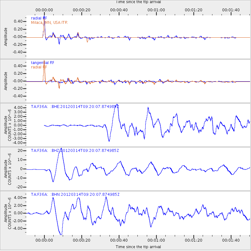
Earthquake location: Off East Coast Of Honshu, Japan
Earthquake latitude/longitude: 40.9/144.9
Earthquake time(UTC): 2012/03/14 (074) 09:08:35 GMT
Earthquake Depth: 12 km
Earthquake Magnitude: 6.7 MB, 6.9 MS, 6.9 MW, 7.0 MW
Earthquake Catalog/Contributor: WHDF/NEIC
Network: TA USArray Transportable Network (new EarthScope stations)
Station: F36A Milaca, MN, USA
Lat/Lon: 45.86 N/93.52 W
Elevation: 345 m
Distance: 79.1 deg
Az: 37.344 deg
Baz: 318.842 deg
Ray Param: 0.04919909
Estimated Moho Depth: 13.25 km
Estimated Crust Vp/Vs: 2.05
Assumed Crust Vp: 6.571 km/s
Estimated Crust Vs: 3.209 km/s
Estimated Crust Poisson's Ratio: 0.34
Radial Match: 97.74577 %
Radial Bump: 321
Transverse Match: 90.51099 %
Transverse Bump: 400
SOD ConfigId: 440406
Insert Time: 2012-05-25 22:52:38.476 +0000
GWidth: 2.5
Max Bumps: 400
Tol: 0.001

Signal To Noise

ChannelStoNSTALTA
TA:F36A: :BHZ:20120314T09:20:07.874985Z35.1242645.0364574E-61.433897E-7
TA:F36A: :BHN:20120314T09:20:07.874985Z18.8951111.5315924E-68.10576E-8
TA:F36A: :BHE:20120314T09:20:07.874985Z14.4052711.3137517E-69.1199375E-8
Arrivals
Ps2.2 SECOND
PpPs6.0 SECOND
PsPs/PpSs8.2 SECOND