G36A St. Michael, MN, USA - Earthquake Result Viewer
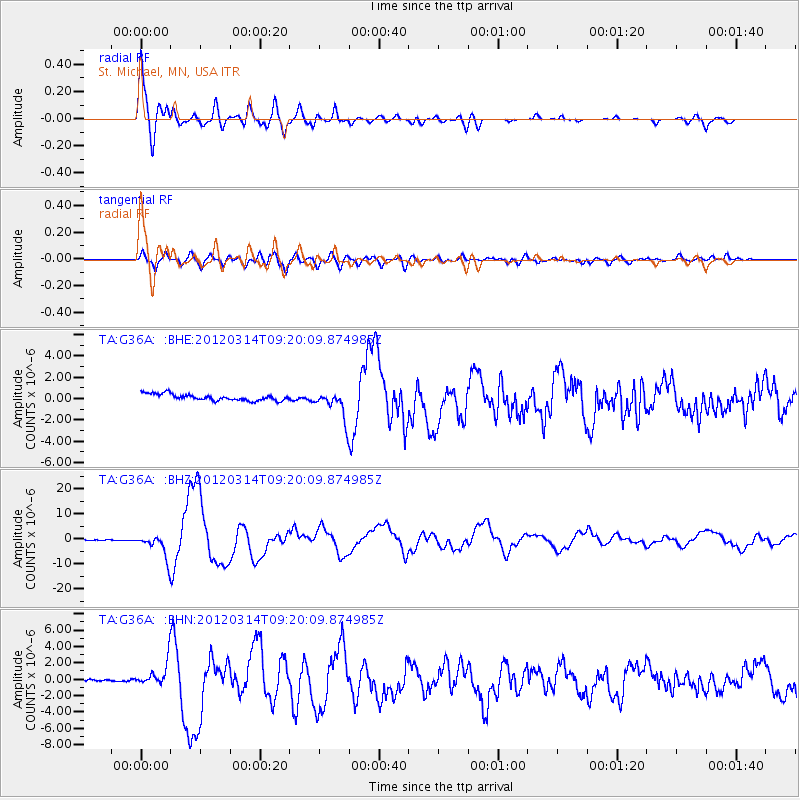
Earthquake location: Off East Coast Of Honshu, Japan
Earthquake latitude/longitude: 40.9/144.9
Earthquake time(UTC): 2012/03/14 (074) 09:08:35 GMT
Earthquake Depth: 12 km
Earthquake Magnitude: 6.7 MB, 6.9 MS, 6.9 MW, 7.0 MW
Earthquake Catalog/Contributor: WHDF/NEIC
Network: TA USArray Transportable Network (new EarthScope stations)
Station: G36A St. Michael, MN, USA
Lat/Lon: 45.23 N/93.75 W
Elevation: 293 m
Distance: 79.5 deg
Az: 37.886 deg
Baz: 318.782 deg
Ray Param: 0.04894736
Estimated Moho Depth: 28.5 km
Estimated Crust Vp/Vs: 2.02
Assumed Crust Vp: 6.571 km/s
Estimated Crust Vs: 3.249 km/s
Estimated Crust Poisson's Ratio: 0.34
Radial Match: 96.34563 %
Radial Bump: 400
Transverse Match: 84.507126 %
Transverse Bump: 400
SOD ConfigId: 440406
Insert Time: 2012-05-25 22:52:42.036 +0000
GWidth: 2.5
Max Bumps: 400
Tol: 0.001

Signal To Noise

ChannelStoNSTALTA
TA:G36A: :BHZ:20120314T09:20:09.874985Z36.9681854.6110313E-61.2472971E-7
TA:G36A: :BHN:20120314T09:20:09.874985Z9.64172651.4347962E-61.4881114E-7
TA:G36A: :BHE:20120314T09:20:09.874985Z4.49009751.3348099E-62.972786E-7
Arrivals
Ps4.6 SECOND
PpPs13 SECOND
PsPs/PpSs17 SECOND