
G35A Watkins, MN, USA - Earthquake Result Viewer
| ||||||||||||||||||
| ||||||||||||||||||
| ||||||||||||||||||
|
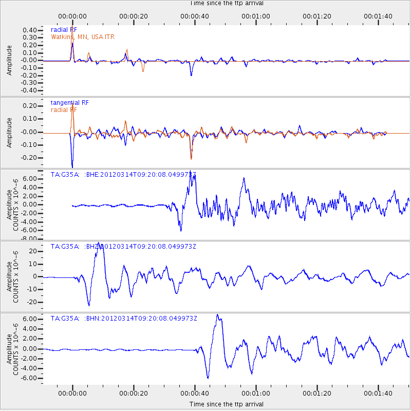
Signal To Noise
| Channel | StoN | STA | LTA |
| TA:G35A: :BHZ:20120314T09:20:08.049973Z | 25.17007 | 4.0625637E-6 | 1.6140454E-7 |
| TA:G35A: :BHN:20120314T09:20:08.049973Z | 0.38785678 | 3.594863E-8 | 9.268532E-8 |
| TA:G35A: :BHE:20120314T09:20:08.049973Z | 7.799314 | 1.1454151E-6 | 1.4686101E-7 |
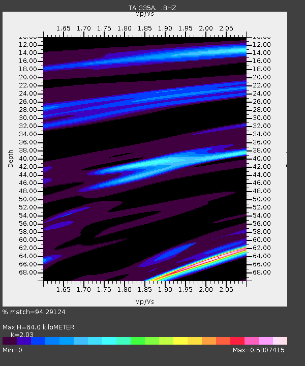
| Arrivals | |
| Ps | 10 SECOND |
| PpPs | 29 SECOND |
| PsPs/PpSs | 39 SECOND |

