C37A Embarrass, MN, USA - Earthquake Result Viewer
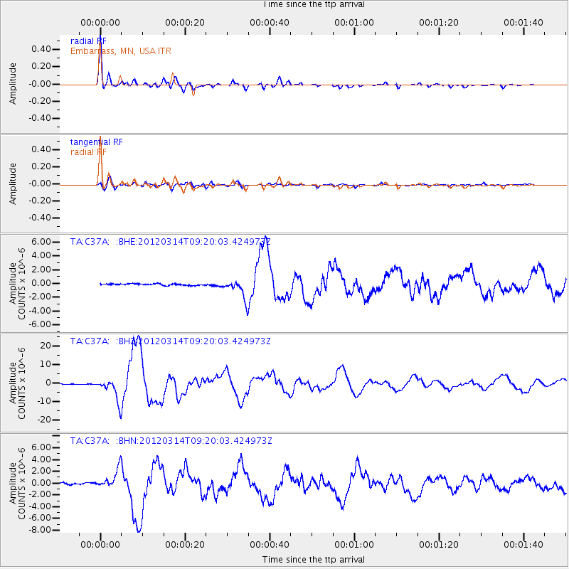
Earthquake location: Off East Coast Of Honshu, Japan
Earthquake latitude/longitude: 40.9/144.9
Earthquake time(UTC): 2012/03/14 (074) 09:08:35 GMT
Earthquake Depth: 12 km
Earthquake Magnitude: 6.7 MB, 6.9 MS, 6.9 MW, 7.0 MW
Earthquake Catalog/Contributor: WHDF/NEIC
Network: TA USArray Transportable Network (new EarthScope stations)
Station: C37A Embarrass, MN, USA
Lat/Lon: 47.73 N/92.19 W
Elevation: 447 m
Distance: 78.3 deg
Az: 35.388 deg
Baz: 319.431 deg
Ray Param: 0.04974903
Estimated Moho Depth: 35.25 km
Estimated Crust Vp/Vs: 1.88
Assumed Crust Vp: 6.571 km/s
Estimated Crust Vs: 3.5 km/s
Estimated Crust Poisson's Ratio: 0.30
Radial Match: 97.656105 %
Radial Bump: 338
Transverse Match: 89.98909 %
Transverse Bump: 400
SOD ConfigId: 440406
Insert Time: 2012-05-25 22:53:06.684 +0000
GWidth: 2.5
Max Bumps: 400
Tol: 0.001

Signal To Noise

ChannelStoNSTALTA
TA:C37A: :BHZ:20120314T09:20:03.424973Z49.8909266.147408E-61.2321695E-7
TA:C37A: :BHN:20120314T09:20:03.424973Z12.9758981.6905233E-61.3028179E-7
TA:C37A: :BHE:20120314T09:20:03.424973Z12.8913651.4521594E-61.1264589E-7
Arrivals
Ps4.8 SECOND
PpPs15 SECOND
PsPs/PpSs20 SECOND