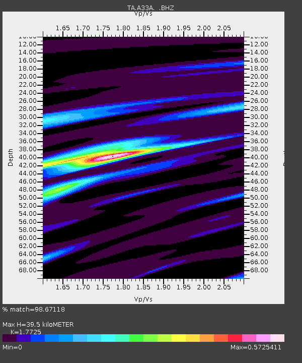
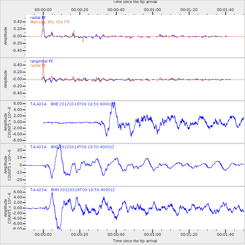
A33A Warroad, MN, USA - Earthquake Result Viewer

Earthquake location: Off East Coast Of Honshu, Japan
Earthquake latitude/longitude: 40.9/144.9
Earthquake time(UTC): 2012/03/14 (074) 09:08:35 GMT
Earthquake Depth: 12 km
Earthquake Magnitude: 6.7 MB, 6.9 MS, 6.9 MW, 7.0 MW
Earthquake Catalog/Contributor: WHDF/NEIC
Network: TA USArray Transportable Network (new EarthScope stations)
Station: A33A Warroad, MN, USA
Lat/Lon: 48.94 N/95.39 W
Elevation: 329 m
Distance: 75.9 deg
Az: 36.202 deg
Baz: 317.225 deg
Ray Param: 0.051319636
Estimated Moho Depth: 39.5 km
Estimated Crust Vp/Vs: 1.77
Assumed Crust Vp: 6.419 km/s
Estimated Crust Vs: 3.622 km/s
Estimated Crust Poisson's Ratio: 0.27
Radial Match: 98.67118 %
Radial Bump: 306
Transverse Match: 85.28012 %
Transverse Bump: 400
SOD ConfigId: 440406
Insert Time: 2012-05-25 22:53:42.586 +0000
GWidth: 2.5
Max Bumps: 400
Tol: 0.001

Signal To Noise

ChannelStoNSTALTA
TA:A33A: :BHZ:20120314T09:19:50.40001Z43.9096455.883866E-61.339994E-7
TA:A33A: :BHN:20120314T09:19:50.40001Z13.4355481.948176E-61.4500161E-7
TA:A33A: :BHE:20120314T09:19:50.40001Z14.4128231.492789E-61.03573676E-7
Arrivals
Ps4.9 SECOND
PpPs17 SECOND
PsPs/PpSs21 SECOND