
T38A Diamond, MO, USA - Earthquake Result Viewer
| ||||||||||||||||||
| ||||||||||||||||||
| ||||||||||||||||||
|
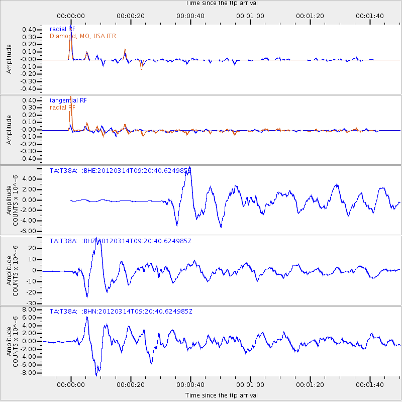
Signal To Noise
| Channel | StoN | STA | LTA |
| TA:T38A: :BHZ:20120314T09:20:40.624985Z | 29.684753 | 4.2152715E-6 | 1.4200123E-7 |
| TA:T38A: :BHN:20120314T09:20:40.624985Z | 8.793281 | 1.1407504E-6 | 1.2972978E-7 |
| TA:T38A: :BHE:20120314T09:20:40.624985Z | 6.3212886 | 7.58224E-7 | 1.199477E-7 |
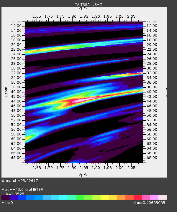
| Arrivals | |
| Ps | 5.7 SECOND |
| PpPs | 18 SECOND |
| PsPs/PpSs | 24 SECOND |

