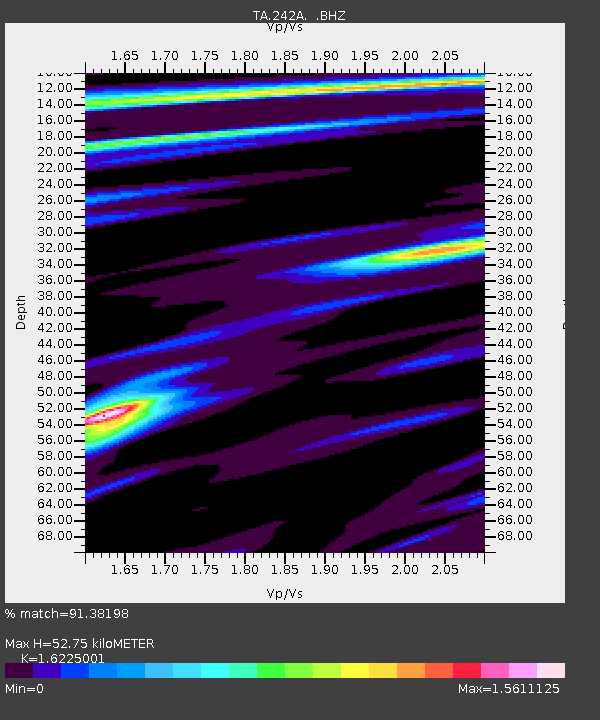
242A Grayson, LA, USA - Earthquake Result Viewer
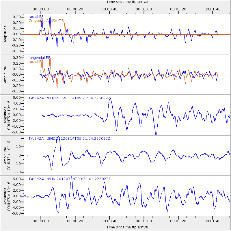
Earthquake location: Off East Coast Of Honshu, Japan
Earthquake latitude/longitude: 40.9/144.9
Earthquake time(UTC): 2012/03/14 (074) 09:08:35 GMT
Earthquake Depth: 12 km
Earthquake Magnitude: 6.7 MB, 6.9 MS, 6.9 MW, 7.0 MW
Earthquake Catalog/Contributor: WHDF/NEIC
Network: TA USArray Transportable Network (new EarthScope stations)
Station: 242A Grayson, LA, USA
Lat/Lon: 32.06 N/92.15 W
Elevation: 57 m
Distance: 90.3 deg
Az: 45.47 deg
Baz: 320.464 deg
Ray Param: 0.041682877
Estimated Moho Depth: 52.75 km
Estimated Crust Vp/Vs: 1.62
Assumed Crust Vp: 6.245 km/s
Estimated Crust Vs: 3.849 km/s
Estimated Crust Poisson's Ratio: 0.19
Radial Match: 91.38198 %
Radial Bump: 400
Transverse Match: 78.61661 %
Transverse Bump: 400
SOD ConfigId: 440406
Insert Time: 2012-05-25 22:59:34.792 +0000
GWidth: 2.5
Max Bumps: 400
Tol: 0.001

Signal To Noise

ChannelStoNSTALTA
TA:242A: :BHZ:20120314T09:21:04.225022Z3.60596517.0240714E-71.9479033E-7
TA:242A: :BHN:20120314T09:21:04.225022Z1.13855872.87927E-72.5288728E-7
TA:242A: :BHE:20120314T09:21:04.225022Z1.71048364.1918082E-72.4506568E-7
Arrivals
Ps5.4 SECOND
PpPs22 SECOND
PsPs/PpSs27 SECOND