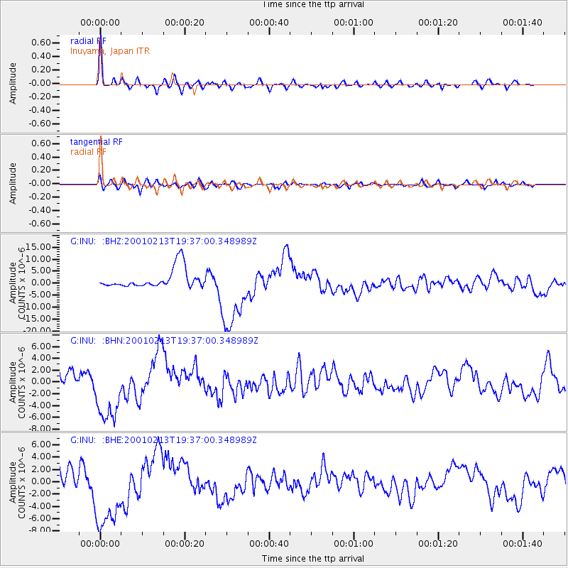
INU Inuyama, Japan - Earthquake Result Viewer
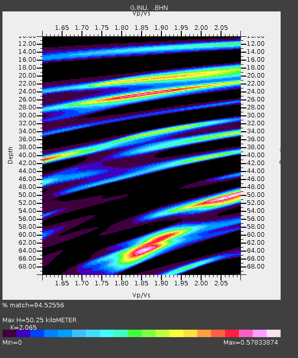
Earthquake location: Southern Sumatra, Indonesia
Earthquake latitude/longitude: -4.7/102.6
Earthquake time(UTC): 2001/02/13 (044) 19:28:30 GMT
Earthquake Depth: 36 km
Earthquake Magnitude: 6.2 MB, 7.2 MS, 7.4 MW, 7.0 ME
Earthquake Catalog/Contributor: WHDF/NEIC
Network: G GEOSCOPE
Station: INU Inuyama, Japan
Lat/Lon: 35.35 N/137.03 E
Elevation: 132 m
Distance: 51.3 deg
Az: 36.347 deg
Baz: 226.272 deg
Ray Param: 0.067423224
Estimated Moho Depth: 50.25 km
Estimated Crust Vp/Vs: 2.07
Assumed Crust Vp: 6.461 km/s
Estimated Crust Vs: 3.129 km/s
Estimated Crust Poisson's Ratio: 0.35
Radial Match: 94.52556 %
Radial Bump: 400
Transverse Match: 72.86482 %
Transverse Bump: 400
SOD ConfigId: 3744
Insert Time: 2010-02-26 23:20:40.764 +0000
GWidth: 2.5
Max Bumps: 400
Tol: 0.001

Signal To Noise

ChannelStoNSTALTA
G:INU: :BHN:20010213T19:37:00.348989Z4.42023665.652228E-61.2787161E-6
G:INU: :BHE:20010213T19:37:00.348989Z4.06276.688204E-61.6462462E-6
G:INU: :BHZ:20010213T19:37:00.348989Z3.91453721.5356432E-53.922924E-6
Arrivals
Ps8.7 SECOND
PpPs23 SECOND
PsPs/PpSs31 SECOND