Y46A Houston, MS, USA - Earthquake Result Viewer
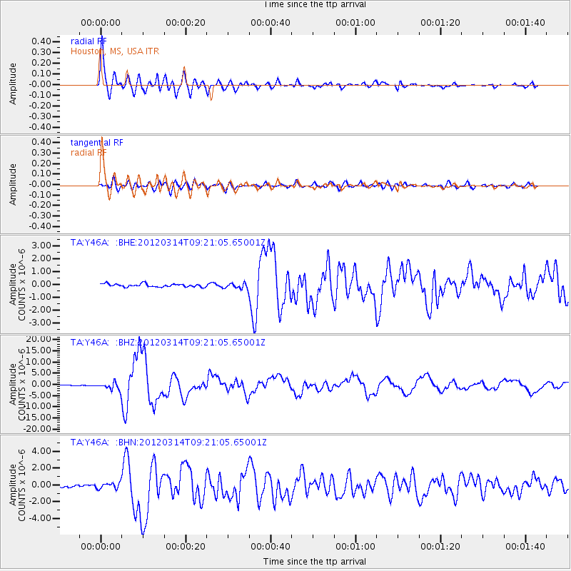
Earthquake location: Off East Coast Of Honshu, Japan
Earthquake latitude/longitude: 40.9/144.9
Earthquake time(UTC): 2012/03/14 (074) 09:08:35 GMT
Earthquake Depth: 12 km
Earthquake Magnitude: 6.7 MB, 6.9 MS, 6.9 MW, 7.0 MW
Earthquake Catalog/Contributor: WHDF/NEIC
Network: TA USArray Transportable Network (new EarthScope stations)
Station: Y46A Houston, MS, USA
Lat/Lon: 33.88 N/88.86 W
Elevation: 109 m
Distance: 90.6 deg
Az: 42.173 deg
Baz: 322.276 deg
Ray Param: 0.041660722
Estimated Moho Depth: 32.25 km
Estimated Crust Vp/Vs: 1.60
Assumed Crust Vp: 6.201 km/s
Estimated Crust Vs: 3.876 km/s
Estimated Crust Poisson's Ratio: 0.18
Radial Match: 97.09453 %
Radial Bump: 400
Transverse Match: 86.4863 %
Transverse Bump: 400
SOD ConfigId: 440406
Insert Time: 2012-05-25 23:03:16.626 +0000
GWidth: 2.5
Max Bumps: 400
Tol: 0.001

Signal To Noise

ChannelStoNSTALTA
TA:Y46A: :BHZ:20120314T09:21:05.65001Z15.9527551.7307816E-61.08494206E-7
TA:Y46A: :BHN:20120314T09:21:05.65001Z2.75434283.664318E-71.3303783E-7
TA:Y46A: :BHE:20120314T09:21:05.65001Z1.83841982.1618399E-71.17592286E-7
Arrivals
Ps3.2 SECOND
PpPs13 SECOND
PsPs/PpSs16 SECOND