
T41A Mountain View, MO, USA - Earthquake Result Viewer
| ||||||||||||||||||
| ||||||||||||||||||
| ||||||||||||||||||
|
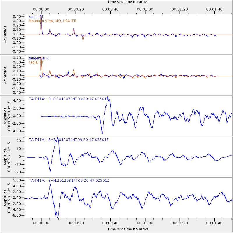
Signal To Noise
| Channel | StoN | STA | LTA |
| TA:T41A: :BHZ:20120314T09:20:47.02501Z | 37.632862 | 3.9846414E-6 | 1.0588197E-7 |
| TA:T41A: :BHN:20120314T09:20:47.02501Z | 8.199134 | 9.440494E-7 | 1.1514014E-7 |
| TA:T41A: :BHE:20120314T09:20:47.02501Z | 11.068787 | 8.437885E-7 | 7.6231345E-8 |
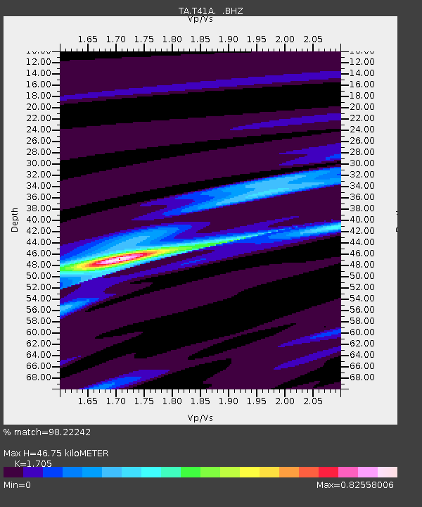
| Arrivals | |
| Ps | 5.2 SECOND |
| PpPs | 19 SECOND |
| PsPs/PpSs | 24 SECOND |

