
S44A Carbondale, IL, USA - Earthquake Result Viewer
| ||||||||||||||||||
| ||||||||||||||||||
| ||||||||||||||||||
|
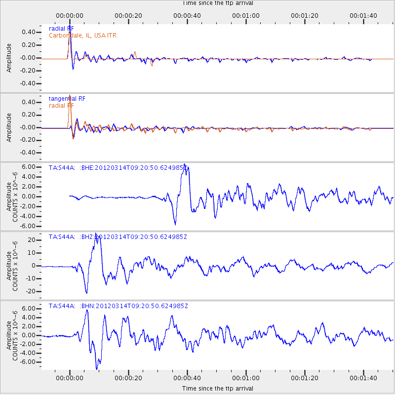
Signal To Noise
| Channel | StoN | STA | LTA |
| TA:S44A: :BHZ:20120314T09:20:50.624985Z | 22.359816 | 2.335318E-6 | 1.04442634E-7 |
| TA:S44A: :BHN:20120314T09:20:50.624985Z | 7.73776 | 8.0181724E-7 | 1.0362395E-7 |
| TA:S44A: :BHE:20120314T09:20:50.624985Z | 3.623227 | 5.1182377E-7 | 1.4126186E-7 |
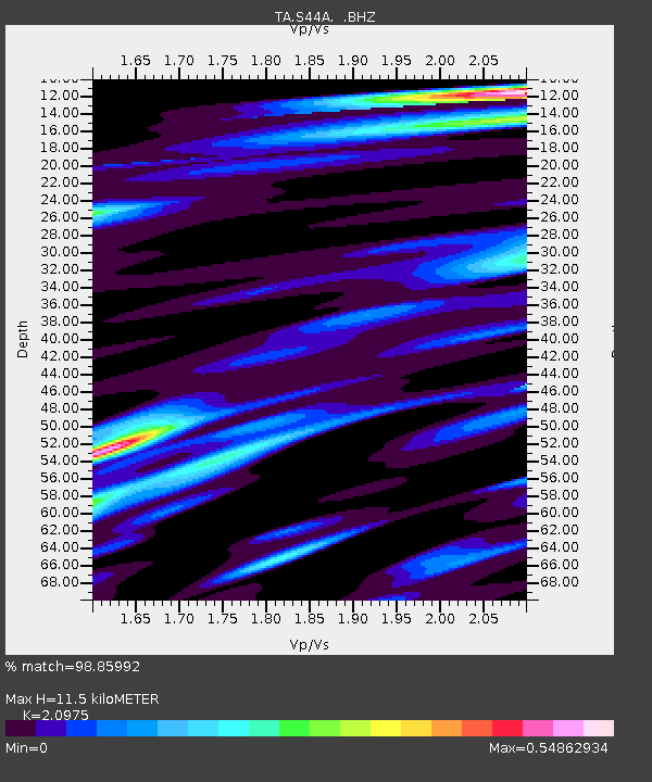
| Arrivals | |
| Ps | 2.0 SECOND |
| PpPs | 5.4 SECOND |
| PsPs/PpSs | 7.4 SECOND |

