L41A Preston, IA, USA - Earthquake Result Viewer
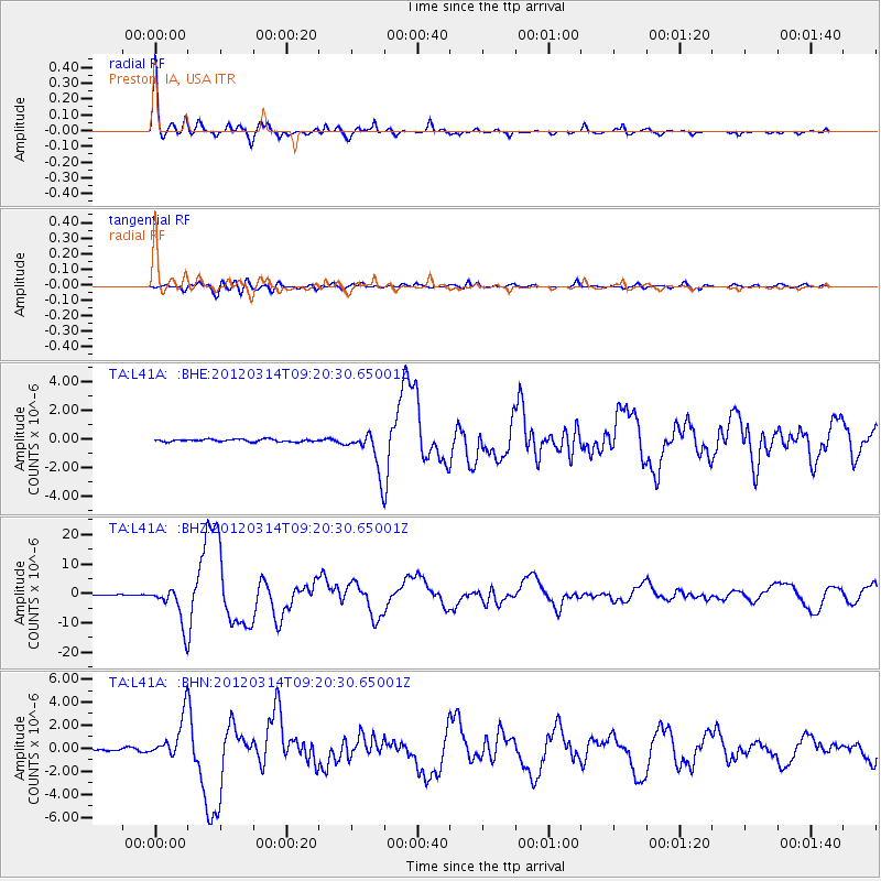
Earthquake location: Off East Coast Of Honshu, Japan
Earthquake latitude/longitude: 40.9/144.9
Earthquake time(UTC): 2012/03/14 (074) 09:08:35 GMT
Earthquake Depth: 12 km
Earthquake Magnitude: 6.7 MB, 6.9 MS, 6.9 MW, 7.0 MW
Earthquake Catalog/Contributor: WHDF/NEIC
Network: TA USArray Transportable Network (new EarthScope stations)
Station: L41A Preston, IA, USA
Lat/Lon: 42.08 N/90.50 W
Elevation: 238 m
Distance: 83.4 deg
Az: 38.115 deg
Baz: 321.055 deg
Ray Param: 0.046220176
Estimated Moho Depth: 39.25 km
Estimated Crust Vp/Vs: 1.75
Assumed Crust Vp: 6.53 km/s
Estimated Crust Vs: 3.726 km/s
Estimated Crust Poisson's Ratio: 0.26
Radial Match: 97.01989 %
Radial Bump: 336
Transverse Match: 87.99089 %
Transverse Bump: 400
SOD ConfigId: 440406
Insert Time: 2012-05-25 23:05:55.786 +0000
GWidth: 2.5
Max Bumps: 400
Tol: 0.001

Signal To Noise

ChannelStoNSTALTA
TA:L41A: :BHZ:20120314T09:20:30.65001Z52.0694856.5292465E-61.2539488E-7
TA:L41A: :BHN:20120314T09:20:30.65001Z13.8587651.7820539E-61.2858679E-7
TA:L41A: :BHE:20120314T09:20:30.65001Z16.5496981.4325927E-68.656308E-8
Arrivals
Ps4.6 SECOND
PpPs16 SECOND
PsPs/PpSs21 SECOND