
K39A Oelwein, IA, USA - Earthquake Result Viewer
| ||||||||||||||||||
| ||||||||||||||||||
| ||||||||||||||||||
|
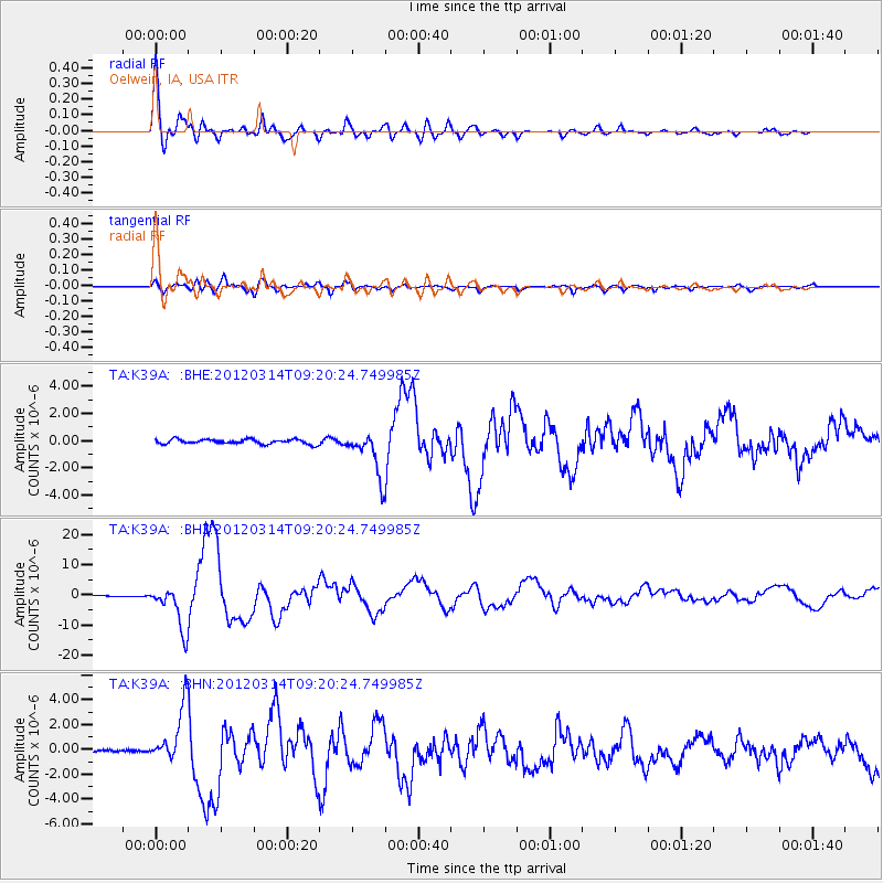
Signal To Noise
| Channel | StoN | STA | LTA |
| TA:K39A: :BHZ:20120314T09:20:24.749985Z | 36.577343 | 7.2661846E-6 | 1.9865261E-7 |
| TA:K39A: :BHN:20120314T09:20:24.749985Z | 15.494672 | 2.311943E-6 | 1.4920892E-7 |
| TA:K39A: :BHE:20120314T09:20:24.749985Z | 9.71093 | 1.6680333E-6 | 1.7176865E-7 |
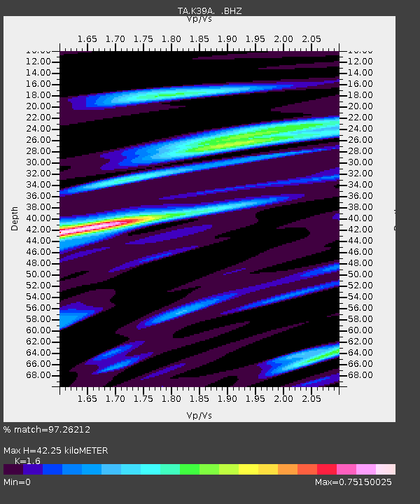
| Arrivals | |
| Ps | 4.0 SECOND |
| PpPs | 16 SECOND |
| PsPs/PpSs | 20 SECOND |

