L39A Vinton, IA, USA - Earthquake Result Viewer
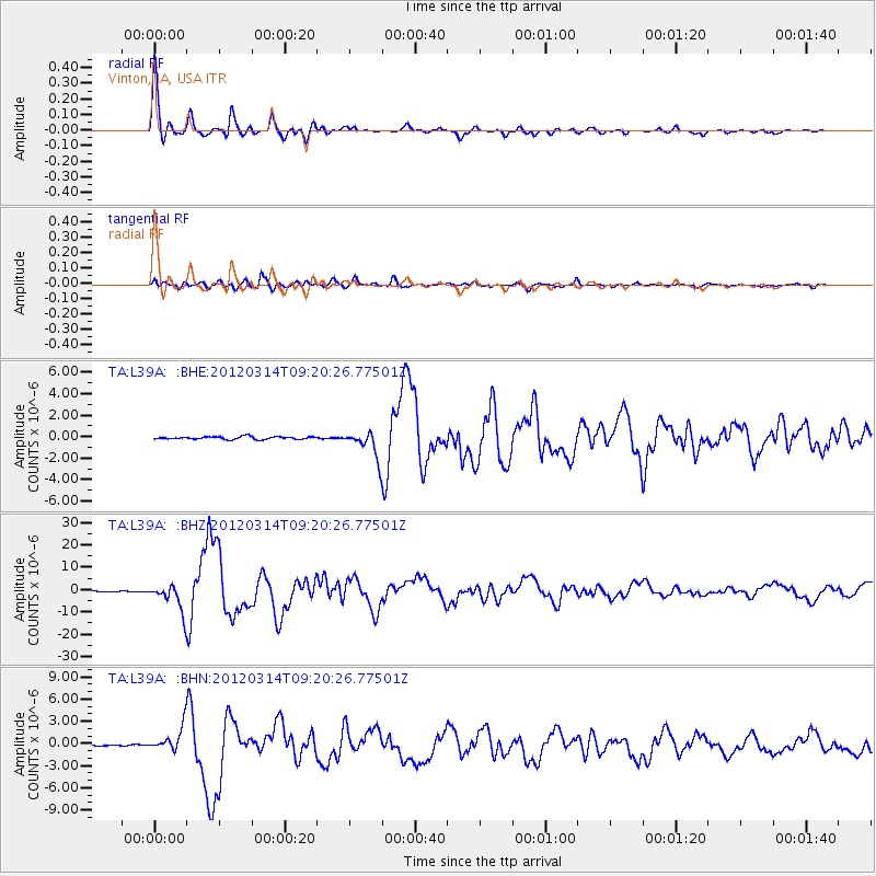
Earthquake location: Off East Coast Of Honshu, Japan
Earthquake latitude/longitude: 40.9/144.9
Earthquake time(UTC): 2012/03/14 (074) 09:08:35 GMT
Earthquake Depth: 12 km
Earthquake Magnitude: 6.7 MB, 6.9 MS, 6.9 MW, 7.0 MW
Earthquake Catalog/Contributor: WHDF/NEIC
Network: TA USArray Transportable Network (new EarthScope stations)
Station: L39A Vinton, IA, USA
Lat/Lon: 42.12 N/92.00 W
Elevation: 261 m
Distance: 82.6 deg
Az: 38.955 deg
Baz: 320.153 deg
Ray Param: 0.046742693
Estimated Moho Depth: 43.0 km
Estimated Crust Vp/Vs: 1.80
Assumed Crust Vp: 6.53 km/s
Estimated Crust Vs: 3.623 km/s
Estimated Crust Poisson's Ratio: 0.28
Radial Match: 98.52946 %
Radial Bump: 348
Transverse Match: 94.68918 %
Transverse Bump: 400
SOD ConfigId: 440406
Insert Time: 2012-05-25 23:06:21.460 +0000
GWidth: 2.5
Max Bumps: 400
Tol: 0.001

Signal To Noise

ChannelStoNSTALTA
TA:L39A: :BHZ:20120314T09:20:26.77501Z40.604866.024853E-61.4837764E-7
TA:L39A: :BHN:20120314T09:20:26.77501Z17.9276031.6369496E-69.13089E-8
TA:L39A: :BHE:20120314T09:20:26.77501Z10.0956791.266077E-61.2540781E-7
Arrivals
Ps5.4 SECOND
PpPs18 SECOND
PsPs/PpSs23 SECOND