P42A Winchester, IL, USA - Earthquake Result Viewer
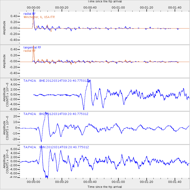
Earthquake location: Off East Coast Of Honshu, Japan
Earthquake latitude/longitude: 40.9/144.9
Earthquake time(UTC): 2012/03/14 (074) 09:08:35 GMT
Earthquake Depth: 12 km
Earthquake Magnitude: 6.7 MB, 6.9 MS, 6.9 MW, 7.0 MW
Earthquake Catalog/Contributor: WHDF/NEIC
Network: TA USArray Transportable Network (new EarthScope stations)
Station: P42A Winchester, IL, USA
Lat/Lon: 39.59 N/90.34 W
Elevation: 197 m
Distance: 85.4 deg
Az: 39.59 deg
Baz: 321.299 deg
Ray Param: 0.044788525
Estimated Moho Depth: 49.5 km
Estimated Crust Vp/Vs: 1.79
Assumed Crust Vp: 6.498 km/s
Estimated Crust Vs: 3.63 km/s
Estimated Crust Poisson's Ratio: 0.27
Radial Match: 98.75927 %
Radial Bump: 228
Transverse Match: 90.032646 %
Transverse Bump: 400
SOD ConfigId: 440406
Insert Time: 2012-05-25 23:06:46.503 +0000
GWidth: 2.5
Max Bumps: 400
Tol: 0.001

Signal To Noise

ChannelStoNSTALTA
TA:P42A: :BHZ:20120314T09:20:40.77501Z27.5265663.7115258E-61.3483431E-7
TA:P42A: :BHN:20120314T09:20:40.77501Z9.182171.2473778E-61.3584783E-7
TA:P42A: :BHE:20120314T09:20:40.77501Z6.21507268.782409E-71.4130822E-7
Arrivals
Ps6.2 SECOND
PpPs21 SECOND
PsPs/PpSs27 SECOND