
U41A Viola, AR, USA - Earthquake Result Viewer
| ||||||||||||||||||
| ||||||||||||||||||
| ||||||||||||||||||
|
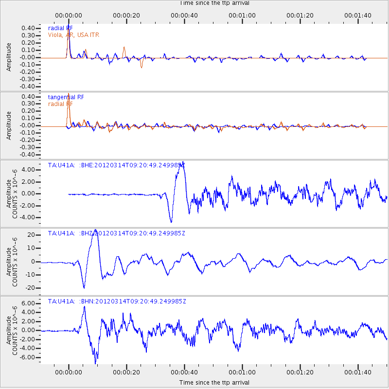
Signal To Noise
| Channel | StoN | STA | LTA |
| TA:U41A: :BHZ:20120314T09:20:49.249985Z | 31.554466 | 3.757364E-6 | 1.1907551E-7 |
| TA:U41A: :BHN:20120314T09:20:49.249985Z | 11.823685 | 9.440527E-7 | 7.9844206E-8 |
| TA:U41A: :BHE:20120314T09:20:49.249985Z | 15.68683 | 8.761498E-7 | 5.5852574E-8 |
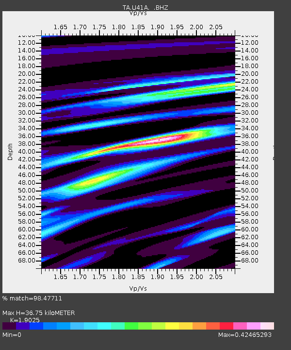
| Arrivals | |
| Ps | 5.2 SECOND |
| PpPs | 16 SECOND |
| PsPs/PpSs | 21 SECOND |

