
R41A Rosebud, MO, USA - Earthquake Result Viewer
| ||||||||||||||||||
| ||||||||||||||||||
| ||||||||||||||||||
|
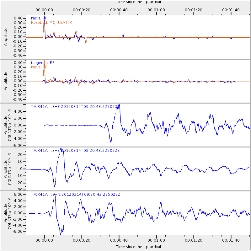
Signal To Noise
| Channel | StoN | STA | LTA |
| TA:R41A: :BHZ:20120314T09:20:43.225022Z | 27.252726 | 3.5667588E-6 | 1.3087714E-7 |
| TA:R41A: :BHN:20120314T09:20:43.225022Z | 11.880011 | 9.962E-7 | 8.385515E-8 |
| TA:R41A: :BHE:20120314T09:20:43.225022Z | 8.289307 | 7.187076E-7 | 8.670298E-8 |
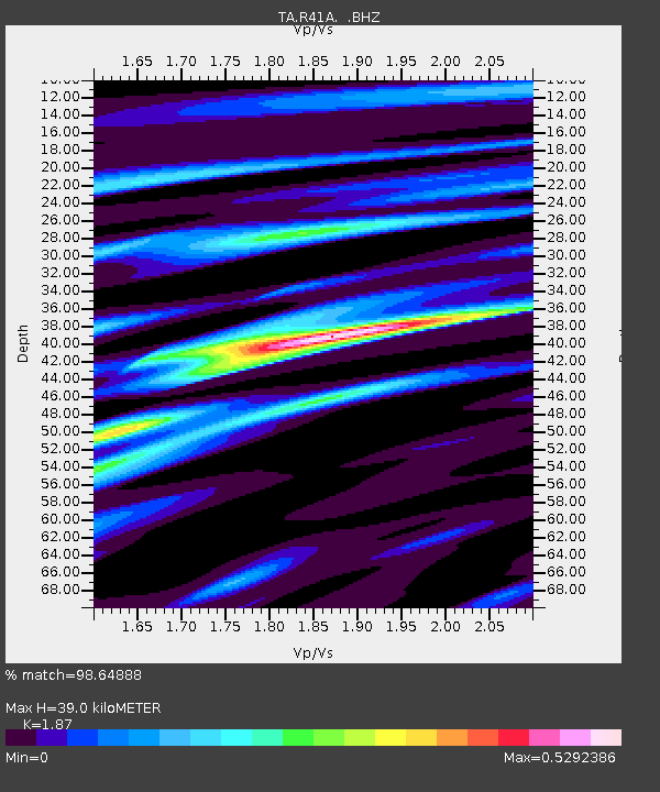
| Arrivals | |
| Ps | 5.3 SECOND |
| PpPs | 17 SECOND |
| PsPs/PpSs | 22 SECOND |

