You are here: Home > Network List > TA - USArray Transportable Network (new EarthScope stations) Stations List
> Station U44A Portageville, MO, USA > Earthquake Result Viewer
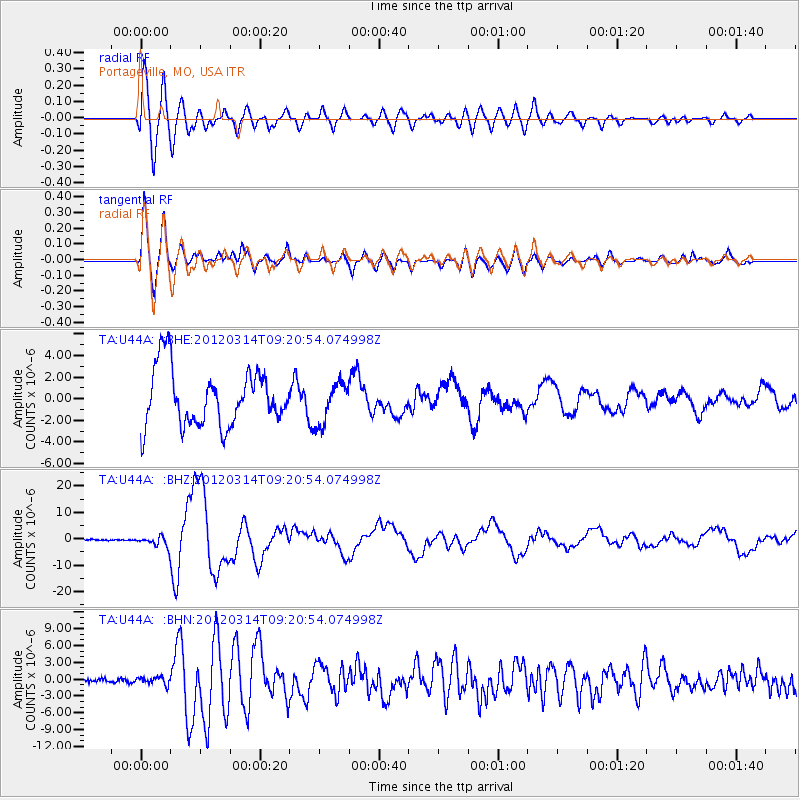
U44A Portageville, MO, USA - Earthquake Result Viewer
*The percent match for this event was below the threshold and hence no stack was calculated.
| Earthquake location: |
Off East Coast Of Honshu, Japan |
| Earthquake latitude/longitude: |
40.9/144.9 |
| Earthquake time(UTC): |
2012/03/14 (074) 09:08:35 GMT |
| Earthquake Depth: |
12 km |
| Earthquake Magnitude: |
6.7 MB, 6.9 MS, 6.9 MW, 7.0 MW |
| Earthquake Catalog/Contributor: |
WHDF/NEIC |
|
| Network: |
TA USArray Transportable Network (new EarthScope stations) |
| Station: |
U44A Portageville, MO, USA |
| Lat/Lon: |
36.50 N/89.69 W |
| Elevation: |
89 m |
|
| Distance: |
88.1 deg |
| Az: |
41.098 deg |
| Baz: |
321.788 deg |
| Ray Param: |
$rayparam |
*The percent match for this event was below the threshold and hence was not used in the summary stack. |
|
| Radial Match: |
83.29266 % |
| Radial Bump: |
400 |
| Transverse Match: |
76.97424 % |
| Transverse Bump: |
400 |
| SOD ConfigId: |
440406 |
| Insert Time: |
2012-05-25 23:07:58.239 +0000 |
| GWidth: |
2.5 |
| Max Bumps: |
400 |
| Tol: |
0.001 |
|
Signal To Noise
| Channel | StoN | STA | LTA |
| TA:U44A: :BHZ:20120314T09:20:54.074998Z | 10.792031 | 2.0066534E-6 | 1.8593843E-7 |
| TA:U44A: :BHN:20120314T09:20:54.074998Z | 1.9994111 | 6.759432E-7 | 3.3807115E-7 |
| TA:U44A: :BHE:20120314T09:20:54.074998Z | 0.72822225 | 1.9054912E-6 | 2.616634E-6 |
| Arrivals |
| Ps | |
| PpPs | |
| PsPs/PpSs | |


