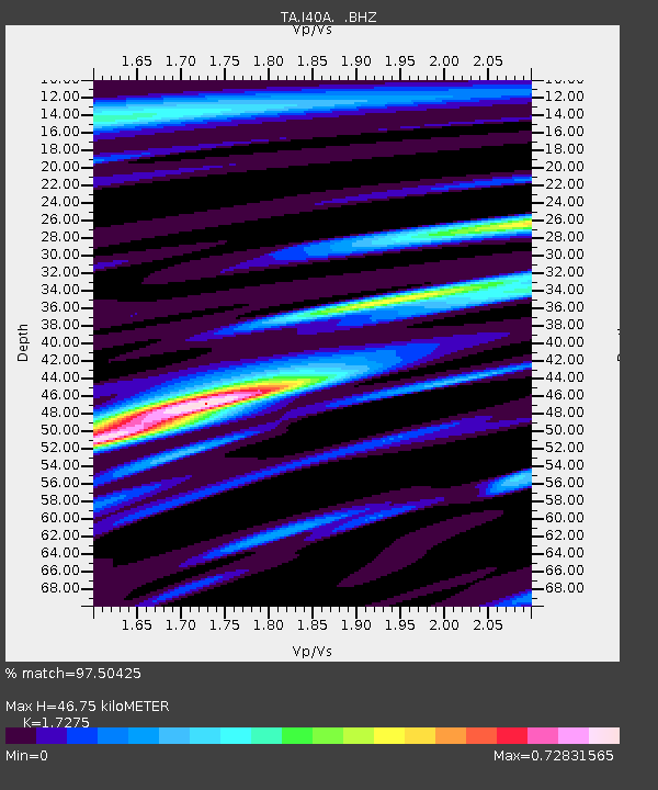
I40A Norwalk, WI, USA - Earthquake Result Viewer

Earthquake location: Off East Coast Of Honshu, Japan
Earthquake latitude/longitude: 40.9/144.9
Earthquake time(UTC): 2012/03/14 (074) 09:08:35 GMT
Earthquake Depth: 12 km
Earthquake Magnitude: 6.7 MB, 6.9 MS, 6.9 MW, 7.0 MW
Earthquake Catalog/Contributor: WHDF/NEIC
Network: TA USArray Transportable Network (new EarthScope stations)
Station: I40A Norwalk, WI, USA
Lat/Lon: 43.89 N/90.62 W
Elevation: 419 m
Distance: 81.9 deg
Az: 37.03 deg
Baz: 320.835 deg
Ray Param: 0.047242194
Estimated Moho Depth: 46.75 km
Estimated Crust Vp/Vs: 1.73
Assumed Crust Vp: 6.53 km/s
Estimated Crust Vs: 3.78 km/s
Estimated Crust Poisson's Ratio: 0.25
Radial Match: 97.50425 %
Radial Bump: 400
Transverse Match: 89.33453 %
Transverse Bump: 400
SOD ConfigId: 440406
Insert Time: 2012-05-25 23:08:25.871 +0000
GWidth: 2.5
Max Bumps: 400
Tol: 0.001

Signal To Noise

ChannelStoNSTALTA
TA:I40A: :BHZ:20120314T09:20:23.049973Z31.0920034.668767E-61.5015974E-7
TA:I40A: :BHN:20120314T09:20:23.049973Z5.89936978.7175033E-71.4777008E-7
TA:I40A: :BHE:20120314T09:20:23.049973Z8.30242351.0208324E-61.2295597E-7
Arrivals
Ps5.4 SECOND
PpPs19 SECOND
PsPs/PpSs24 SECOND