H39A Augusta, WI, USA - Earthquake Result Viewer
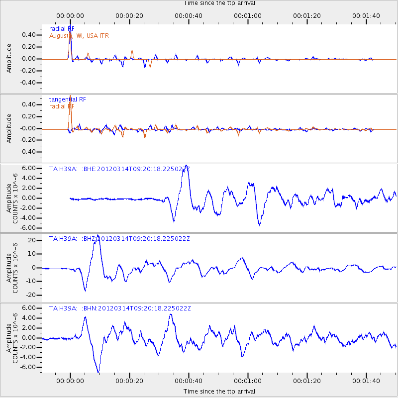
Earthquake location: Off East Coast Of Honshu, Japan
Earthquake latitude/longitude: 40.9/144.9
Earthquake time(UTC): 2012/03/14 (074) 09:08:35 GMT
Earthquake Depth: 12 km
Earthquake Magnitude: 6.7 MB, 6.9 MS, 6.9 MW, 7.0 MW
Earthquake Catalog/Contributor: WHDF/NEIC
Network: TA USArray Transportable Network (new EarthScope stations)
Station: H39A Augusta, WI, USA
Lat/Lon: 44.68 N/91.28 W
Elevation: 345 m
Distance: 81.0 deg
Az: 36.898 deg
Baz: 320.352 deg
Ray Param: 0.047883246
Estimated Moho Depth: 53.25 km
Estimated Crust Vp/Vs: 1.60
Assumed Crust Vp: 6.571 km/s
Estimated Crust Vs: 4.107 km/s
Estimated Crust Poisson's Ratio: 0.18
Radial Match: 98.11714 %
Radial Bump: 227
Transverse Match: 95.09488 %
Transverse Bump: 400
SOD ConfigId: 440406
Insert Time: 2012-05-25 23:09:15.687 +0000
GWidth: 2.5
Max Bumps: 400
Tol: 0.001

Signal To Noise

ChannelStoNSTALTA
TA:H39A: :BHZ:20120314T09:20:18.225022Z39.730044.5116067E-61.1355655E-7
TA:H39A: :BHN:20120314T09:20:18.225022Z13.8973271.280415E-69.21339E-8
TA:H39A: :BHE:20120314T09:20:18.225022Z15.0569981.2761552E-68.475496E-8
Arrivals
Ps5.0 SECOND
PpPs20 SECOND
PsPs/PpSs25 SECOND