You are here: Home > Network List > TA - USArray Transportable Network (new EarthScope stations) Stations List
> Station E38A The Farm, Brule, WI, USA > Earthquake Result Viewer
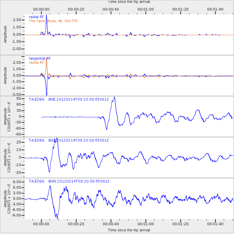
E38A The Farm, Brule, WI, USA - Earthquake Result Viewer
*The percent match for this event was below the threshold and hence no stack was calculated.
| Earthquake location: |
Off East Coast Of Honshu, Japan |
| Earthquake latitude/longitude: |
40.9/144.9 |
| Earthquake time(UTC): |
2012/03/14 (074) 09:08:35 GMT |
| Earthquake Depth: |
12 km |
| Earthquake Magnitude: |
6.7 MB, 6.9 MS, 6.9 MW, 7.0 MW |
| Earthquake Catalog/Contributor: |
WHDF/NEIC |
|
| Network: |
TA USArray Transportable Network (new EarthScope stations) |
| Station: |
E38A The Farm, Brule, WI, USA |
| Lat/Lon: |
46.61 N/91.55 W |
| Elevation: |
341 m |
|
| Distance: |
79.4 deg |
| Az: |
35.794 deg |
| Baz: |
319.971 deg |
| Ray Param: |
$rayparam |
*The percent match for this event was below the threshold and hence was not used in the summary stack. |
|
| Radial Match: |
98.765076 % |
| Radial Bump: |
178 |
| Transverse Match: |
98.80343 % |
| Transverse Bump: |
195 |
| SOD ConfigId: |
440406 |
| Insert Time: |
2012-05-25 23:10:41.374 +0000 |
| GWidth: |
2.5 |
| Max Bumps: |
400 |
| Tol: |
0.001 |
|
Signal To Noise
| Channel | StoN | STA | LTA |
| TA:E38A: :BHZ:20120314T09:20:09.65001Z | 54.712955 | 6.88146E-6 | 1.2577388E-7 |
| TA:E38A: :BHN:20120314T09:20:09.65001Z | 13.656813 | 2.011279E-6 | 1.4727296E-7 |
| TA:E38A: :BHE:20120314T09:20:09.65001Z | 7.375545 | 2.7293408E-6 | 3.700528E-7 |
| Arrivals |
| Ps | |
| PpPs | |
| PsPs/PpSs | |


