
F39A Loretta, WI, USA - Earthquake Result Viewer
| ||||||||||||||||||
| ||||||||||||||||||
| ||||||||||||||||||
|
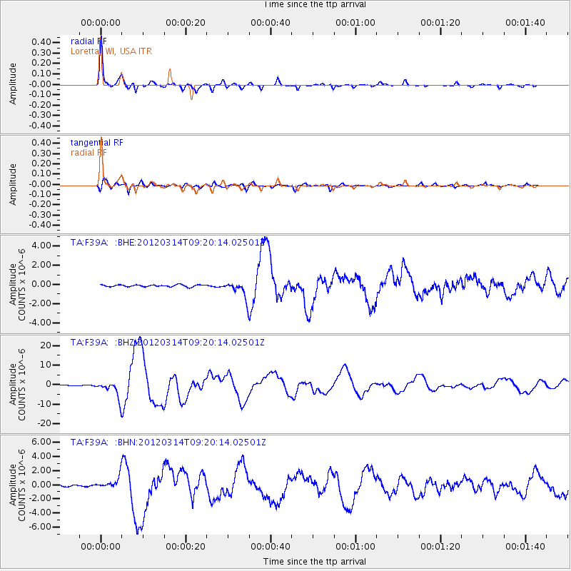
Signal To Noise
| Channel | StoN | STA | LTA |
| TA:F39A: :BHZ:20120314T09:20:14.02501Z | 34.185944 | 4.4606695E-6 | 1.3048256E-7 |
| TA:F39A: :BHN:20120314T09:20:14.02501Z | 8.054217 | 8.675059E-7 | 1.0770829E-7 |
| TA:F39A: :BHE:20120314T09:20:14.02501Z | 9.817633 | 9.711472E-7 | 9.8918676E-8 |
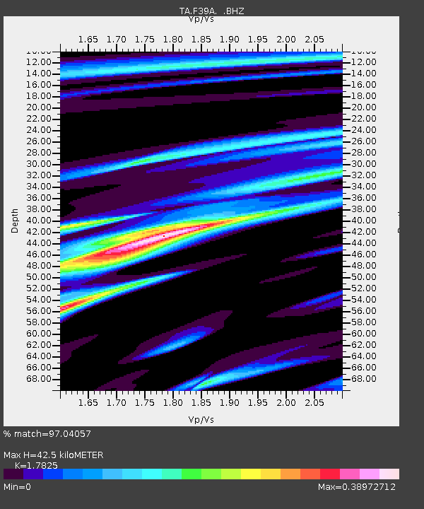
| Arrivals | |
| Ps | 5.2 SECOND |
| PpPs | 17 SECOND |
| PsPs/PpSs | 23 SECOND |

