
G43A Wallace, MI, USA - Earthquake Result Viewer
| ||||||||||||||||||
| ||||||||||||||||||
| ||||||||||||||||||
|
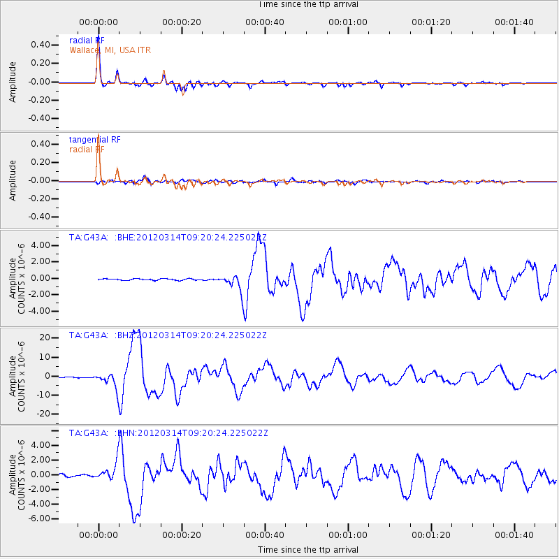
Signal To Noise
| Channel | StoN | STA | LTA |
| TA:G43A: :BHZ:20120314T09:20:24.225022Z | 35.26228 | 4.3335885E-6 | 1.2289587E-7 |
| TA:G43A: :BHN:20120314T09:20:24.225022Z | 8.916871 | 1.2851965E-6 | 1.4413088E-7 |
| TA:G43A: :BHE:20120314T09:20:24.225022Z | 12.053367 | 1.102429E-6 | 9.1462326E-8 |
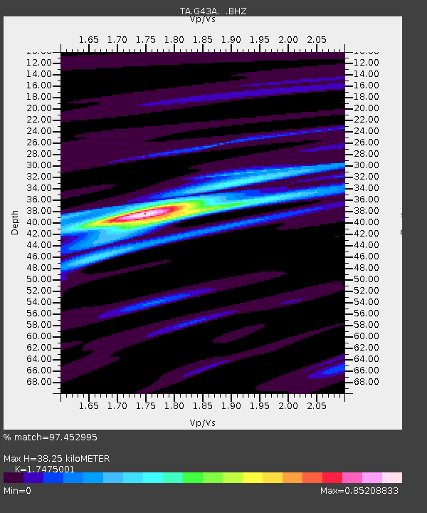
| Arrivals | |
| Ps | 4.5 SECOND |
| PpPs | 16 SECOND |
| PsPs/PpSs | 20 SECOND |

