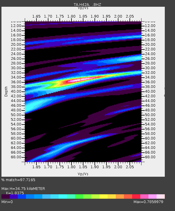
H42A Shiocton, WI, USA - Earthquake Result Viewer

Earthquake location: Off East Coast Of Honshu, Japan
Earthquake latitude/longitude: 40.9/144.9
Earthquake time(UTC): 2012/03/14 (074) 09:08:35 GMT
Earthquake Depth: 12 km
Earthquake Magnitude: 6.7 MB, 6.9 MS, 6.9 MW, 7.0 MW
Earthquake Catalog/Contributor: WHDF/NEIC
Network: TA USArray Transportable Network (new EarthScope stations)
Station: H42A Shiocton, WI, USA
Lat/Lon: 44.51 N/88.53 W
Elevation: 244 m
Distance: 82.4 deg
Az: 35.457 deg
Baz: 322.07 deg
Ray Param: 0.04692709
Estimated Moho Depth: 34.75 km
Estimated Crust Vp/Vs: 1.84
Assumed Crust Vp: 6.41 km/s
Estimated Crust Vs: 3.489 km/s
Estimated Crust Poisson's Ratio: 0.29
Radial Match: 97.7165 %
Radial Bump: 235
Transverse Match: 86.371346 %
Transverse Bump: 400
SOD ConfigId: 440406
Insert Time: 2012-05-25 23:12:45.756 +0000
GWidth: 2.5
Max Bumps: 400
Tol: 0.001

Signal To Noise

ChannelStoNSTALTA
TA:H42A: :BHZ:20120314T09:20:25.40001Z26.1455334.1534668E-61.5885952E-7
TA:H42A: :BHN:20120314T09:20:25.40001Z8.4944861.2008741E-61.41371E-7
TA:H42A: :BHE:20120314T09:20:25.40001Z7.67034449.935453E-71.2953073E-7
Arrivals
Ps4.7 SECOND
PpPs15 SECOND
PsPs/PpSs20 SECOND