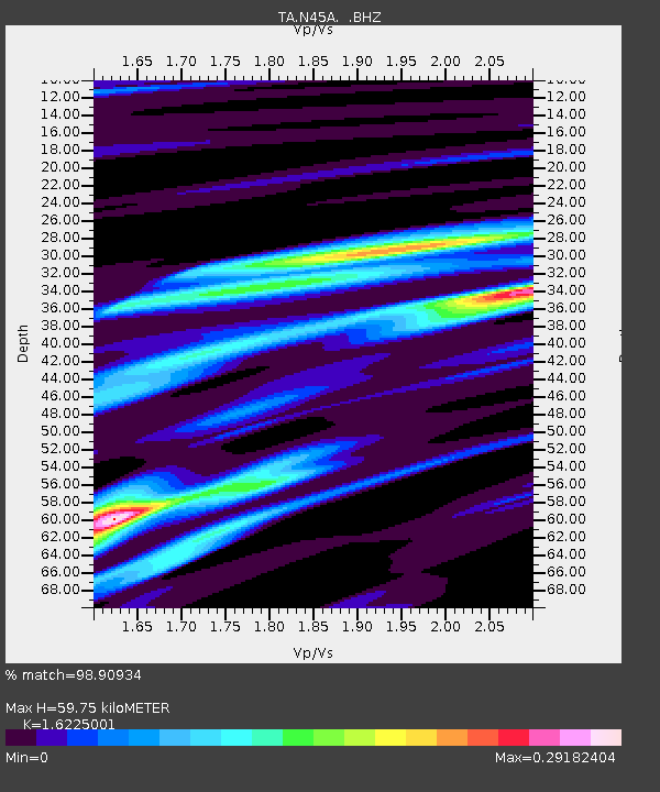
N45A Kentland, IN, USA - Earthquake Result Viewer
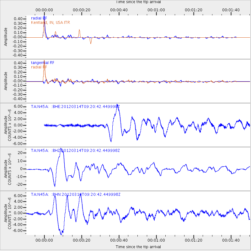
Earthquake location: Off East Coast Of Honshu, Japan
Earthquake latitude/longitude: 40.9/144.9
Earthquake time(UTC): 2012/03/14 (074) 09:08:35 GMT
Earthquake Depth: 12 km
Earthquake Magnitude: 6.7 MB, 6.9 MS, 6.9 MW, 7.0 MW
Earthquake Catalog/Contributor: WHDF/NEIC
Network: TA USArray Transportable Network (new EarthScope stations)
Station: N45A Kentland, IN, USA
Lat/Lon: 40.85 N/87.51 W
Elevation: 206 m
Distance: 85.7 deg
Az: 37.097 deg
Baz: 322.929 deg
Ray Param: 0.044547025
Estimated Moho Depth: 59.75 km
Estimated Crust Vp/Vs: 1.62
Assumed Crust Vp: 6.498 km/s
Estimated Crust Vs: 4.005 km/s
Estimated Crust Poisson's Ratio: 0.19
Radial Match: 98.90934 %
Radial Bump: 213
Transverse Match: 93.93149 %
Transverse Bump: 400
SOD ConfigId: 440406
Insert Time: 2012-05-25 23:13:37.768 +0000
GWidth: 2.5
Max Bumps: 400
Tol: 0.001

Signal To Noise

ChannelStoNSTALTA
TA:N45A: :BHZ:20120314T09:20:42.449998Z20.0271513.0527603E-61.5243108E-7
TA:N45A: :BHN:20120314T09:20:42.449998Z4.9712687.333636E-71.4752042E-7
TA:N45A: :BHE:20120314T09:20:42.449998Z3.96477536.3415956E-71.5994841E-7
Arrivals
Ps5.9 SECOND
PpPs23 SECOND
PsPs/PpSs29 SECOND