N46A Monticello, IN, USA - Earthquake Result Viewer
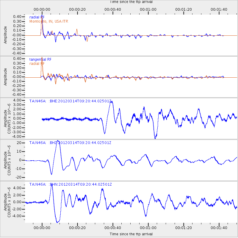
Earthquake location: Off East Coast Of Honshu, Japan
Earthquake latitude/longitude: 40.9/144.9
Earthquake time(UTC): 2012/03/14 (074) 09:08:35 GMT
Earthquake Depth: 12 km
Earthquake Magnitude: 6.7 MB, 6.9 MS, 6.9 MW, 7.0 MW
Earthquake Catalog/Contributor: WHDF/NEIC
Network: TA USArray Transportable Network (new EarthScope stations)
Station: N46A Monticello, IN, USA
Lat/Lon: 40.89 N/86.74 W
Elevation: 209 m
Distance: 86.1 deg
Az: 36.596 deg
Baz: 323.399 deg
Ray Param: 0.044322684
Estimated Moho Depth: 20.75 km
Estimated Crust Vp/Vs: 2.02
Assumed Crust Vp: 6.498 km/s
Estimated Crust Vs: 3.221 km/s
Estimated Crust Poisson's Ratio: 0.34
Radial Match: 98.167534 %
Radial Bump: 313
Transverse Match: 92.06478 %
Transverse Bump: 400
SOD ConfigId: 440406
Insert Time: 2012-05-25 23:13:40.022 +0000
GWidth: 2.5
Max Bumps: 400
Tol: 0.001

Signal To Noise

ChannelStoNSTALTA
TA:N46A: :BHZ:20120314T09:20:44.02501Z26.9271013.0866404E-61.1462951E-7
TA:N46A: :BHN:20120314T09:20:44.02501Z8.0407818.2703093E-71.0285455E-7
TA:N46A: :BHE:20120314T09:20:44.02501Z4.43195155.952759E-71.3431463E-7
Arrivals
Ps3.3 SECOND
PpPs9.4 SECOND
PsPs/PpSs13 SECOND