Y48A Jasper, AL, USA - Earthquake Result Viewer
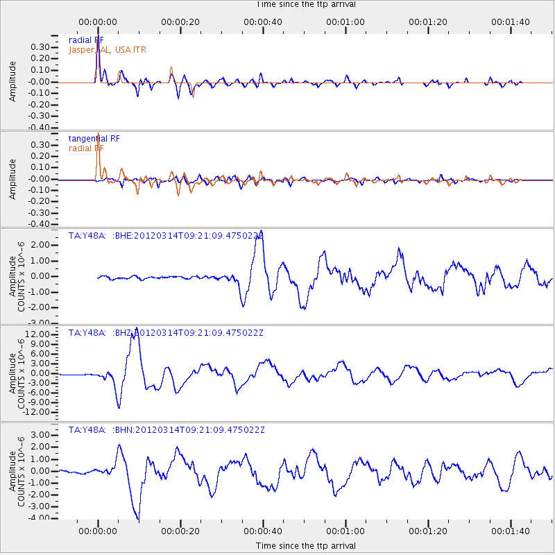
Earthquake location: Off East Coast Of Honshu, Japan
Earthquake latitude/longitude: 40.9/144.9
Earthquake time(UTC): 2012/03/14 (074) 09:08:35 GMT
Earthquake Depth: 12 km
Earthquake Magnitude: 6.7 MB, 6.9 MS, 6.9 MW, 7.0 MW
Earthquake Catalog/Contributor: WHDF/NEIC
Network: TA USArray Transportable Network (new EarthScope stations)
Station: Y48A Jasper, AL, USA
Lat/Lon: 33.91 N/87.17 W
Elevation: 170 m
Distance: 91.4 deg
Az: 41.037 deg
Baz: 323.233 deg
Ray Param: 0.041601826
Estimated Moho Depth: 41.5 km
Estimated Crust Vp/Vs: 1.91
Assumed Crust Vp: 6.565 km/s
Estimated Crust Vs: 3.432 km/s
Estimated Crust Poisson's Ratio: 0.31
Radial Match: 96.30975 %
Radial Bump: 383
Transverse Match: 86.87541 %
Transverse Bump: 400
SOD ConfigId: 440406
Insert Time: 2012-05-25 23:17:09.911 +0000
GWidth: 2.5
Max Bumps: 400
Tol: 0.001

Signal To Noise

ChannelStoNSTALTA
TA:Y48A: :BHZ:20120314T09:21:09.475022Z26.3117872.7924216E-61.0612817E-7
TA:Y48A: :BHN:20120314T09:21:09.475022Z4.91138845.27256E-71.07353756E-7
TA:Y48A: :BHE:20120314T09:21:09.475022Z5.69007544.3179168E-77.5885055E-8
Arrivals
Ps5.9 SECOND
PpPs18 SECOND
PsPs/PpSs24 SECOND