
W48A Pulaski, TN, USA - Earthquake Result Viewer
| ||||||||||||||||||
| ||||||||||||||||||
| ||||||||||||||||||
|
Signal To Noise
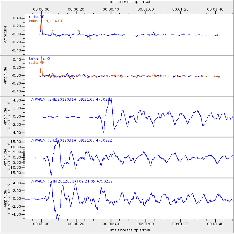
| Channel | StoN | STA | LTA |
| TA:W48A: :BHZ:20120314T09:21:05.475022Z | 23.549328 | 1.9431625E-6 | 8.251456E-8 |
| TA:W48A: :BHN:20120314T09:21:05.475022Z | 9.516955 | 4.8578073E-7 | 5.1043713E-8 |
| TA:W48A: :BHE:20120314T09:21:05.475022Z | 5.1023393 | 3.9696886E-7 | 7.7801346E-8 |
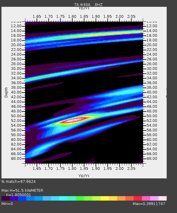
| Arrivals | |
| Ps | 6.5 SECOND |
| PpPs | 22 SECOND |
| PsPs/PpSs | 28 SECOND |

