149A Jones, AL, USA - Earthquake Result Viewer
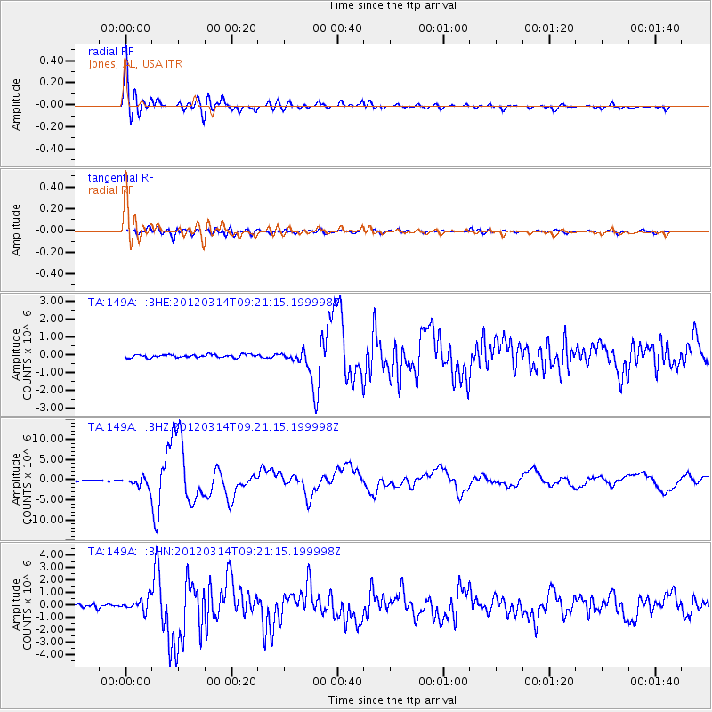
Earthquake location: Off East Coast Of Honshu, Japan
Earthquake latitude/longitude: 40.9/144.9
Earthquake time(UTC): 2012/03/14 (074) 09:08:35 GMT
Earthquake Depth: 12 km
Earthquake Magnitude: 6.7 MB, 6.9 MS, 6.9 MW, 7.0 MW
Earthquake Catalog/Contributor: WHDF/NEIC
Network: TA USArray Transportable Network (new EarthScope stations)
Station: 149A Jones, AL, USA
Lat/Lon: 32.60 N/86.79 W
Elevation: 138 m
Distance: 92.7 deg
Az: 41.566 deg
Baz: 323.42 deg
Ray Param: 0.041410226
Estimated Moho Depth: 41.5 km
Estimated Crust Vp/Vs: 1.97
Assumed Crust Vp: 6.565 km/s
Estimated Crust Vs: 3.332 km/s
Estimated Crust Poisson's Ratio: 0.33
Radial Match: 96.01427 %
Radial Bump: 400
Transverse Match: 82.46188 %
Transverse Bump: 400
SOD ConfigId: 440406
Insert Time: 2012-05-25 23:18:12.008 +0000
GWidth: 2.5
Max Bumps: 400
Tol: 0.001

Signal To Noise

ChannelStoNSTALTA
TA:149A: :BHZ:20120314T09:21:15.199998Z11.1169141.2782517E-61.1498261E-7
TA:149A: :BHN:20120314T09:21:15.199998Z4.97185565.173061E-71.0404688E-7
TA:149A: :BHE:20120314T09:21:15.199998Z3.8056993.225857E-78.476385E-8
Arrivals
Ps6.3 SECOND
PpPs18 SECOND
PsPs/PpSs25 SECOND