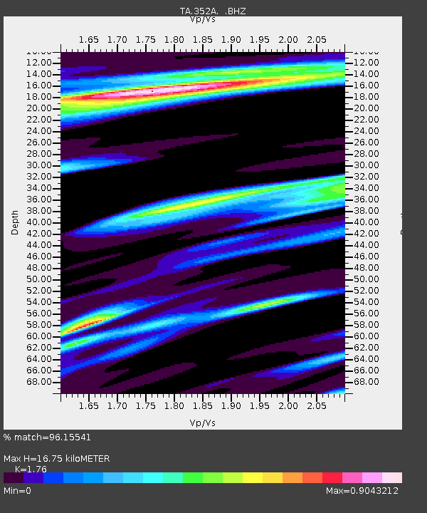
352A Blakely, GA, USA - Earthquake Result Viewer
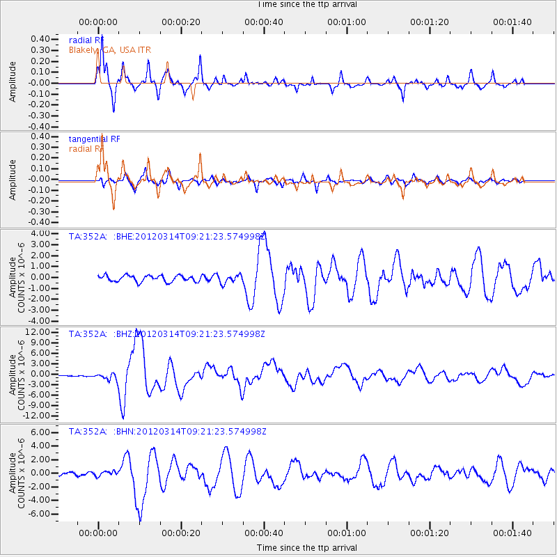
Earthquake location: Off East Coast Of Honshu, Japan
Earthquake latitude/longitude: 40.9/144.9
Earthquake time(UTC): 2012/03/14 (074) 09:08:35 GMT
Earthquake Depth: 12 km
Earthquake Magnitude: 6.7 MB, 6.9 MS, 6.9 MW, 7.0 MW
Earthquake Catalog/Contributor: WHDF/NEIC
Network: TA USArray Transportable Network (new EarthScope stations)
Station: 352A Blakely, GA, USA
Lat/Lon: 31.48 N/84.93 W
Elevation: 101 m
Distance: 94.5 deg
Az: 40.942 deg
Baz: 324.444 deg
Ray Param: 0.04102527
Estimated Moho Depth: 16.75 km
Estimated Crust Vp/Vs: 1.76
Assumed Crust Vp: 6.347 km/s
Estimated Crust Vs: 3.606 km/s
Estimated Crust Poisson's Ratio: 0.26
Radial Match: 96.15541 %
Radial Bump: 349
Transverse Match: 84.66116 %
Transverse Bump: 400
SOD ConfigId: 440406
Insert Time: 2012-05-25 23:19:31.736 +0000
GWidth: 2.5
Max Bumps: 400
Tol: 0.001

Signal To Noise

ChannelStoNSTALTA
TA:352A: :BHZ:20120314T09:21:23.574998Z8.1505891.0531795E-61.2921514E-7
TA:352A: :BHN:20120314T09:21:23.574998Z1.53541363.5407365E-72.3060473E-7
TA:352A: :BHE:20120314T09:21:23.574998Z1.3331263.7797506E-72.835254E-7
Arrivals
Ps2.0 SECOND
PpPs7.1 SECOND
PsPs/PpSs9.2 SECOND