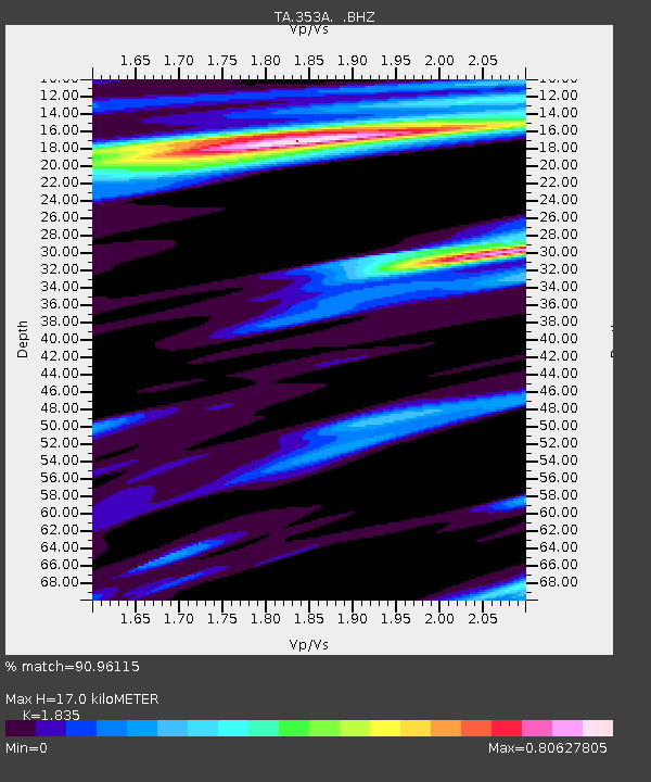
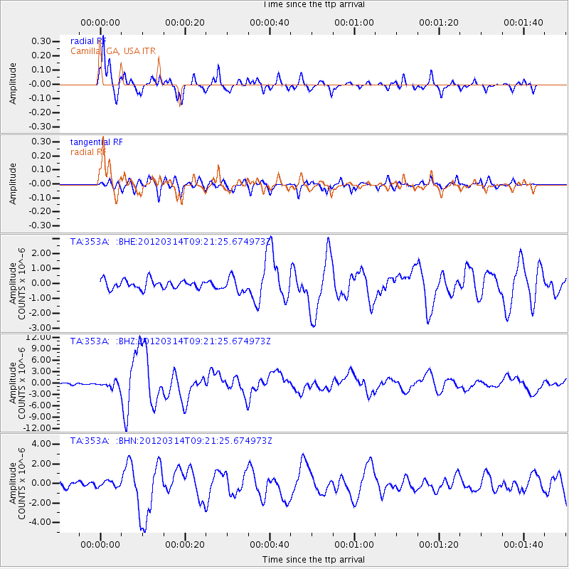
353A Camilla, GA, USA - Earthquake Result Viewer

Earthquake location: Off East Coast Of Honshu, Japan
Earthquake latitude/longitude: 40.9/144.9
Earthquake time(UTC): 2012/03/14 (074) 09:08:35 GMT
Earthquake Depth: 12 km
Earthquake Magnitude: 6.7 MB, 6.9 MS, 6.9 MW, 7.0 MW
Earthquake Catalog/Contributor: WHDF/NEIC
Network: TA USArray Transportable Network (new EarthScope stations)
Station: 353A Camilla, GA, USA
Lat/Lon: 31.35 N/84.22 W
Elevation: 54 m
Distance: 95.0 deg
Az: 40.521 deg
Baz: 324.847 deg
Ray Param: 0.04090545
Estimated Moho Depth: 17.0 km
Estimated Crust Vp/Vs: 1.84
Assumed Crust Vp: 6.347 km/s
Estimated Crust Vs: 3.459 km/s
Estimated Crust Poisson's Ratio: 0.29
Radial Match: 90.96115 %
Radial Bump: 377
Transverse Match: 81.92561 %
Transverse Bump: 400
SOD ConfigId: 440406
Insert Time: 2012-05-25 23:19:35.626 +0000
GWidth: 2.5
Max Bumps: 400
Tol: 0.001

Signal To Noise

ChannelStoNSTALTA
TA:353A: :BHZ:20120314T09:21:25.674973Z4.1988968.920374E-72.124457E-7
TA:353A: :BHN:20120314T09:21:25.674973Z1.35818983.0302903E-72.2311242E-7
TA:353A: :BHE:20120314T09:21:25.674973Z1.72549194.957741E-72.8732333E-7
Arrivals
Ps2.3 SECOND
PpPs7.5 SECOND
PsPs/PpSs9.7 SECOND