
GNW Green Mountain (BB) - Earthquake Result Viewer
| ||||||||||||||||||
| ||||||||||||||||||
| ||||||||||||||||||
|
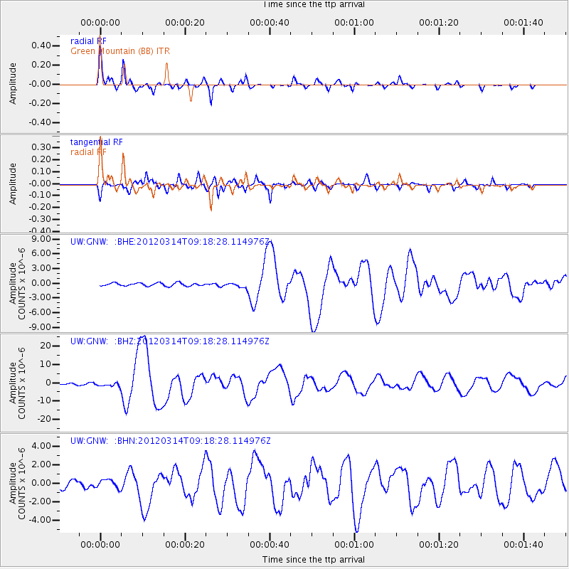
Signal To Noise
| Channel | StoN | STA | LTA |
| UW:GNW: :BHZ:20120314T09:18:28.114976Z | 4.106761 | 1.0806434E-6 | 2.6313765E-7 |
| UW:GNW: :BHN:20120314T09:18:28.114976Z | 1.0329263 | 4.6817814E-7 | 4.5325416E-7 |
| UW:GNW: :BHE:20120314T09:18:28.114976Z | 1.6011331 | 5.014537E-7 | 3.1318675E-7 |
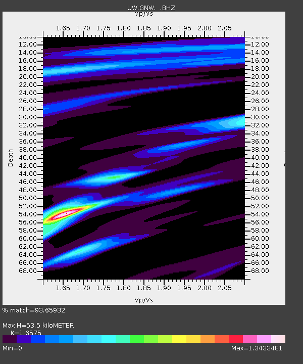
| Arrivals | |
| Ps | 5.6 SECOND |
| PpPs | 21 SECOND |
| PsPs/PpSs | 26 SECOND |

