HOOD Mt Hood Meadows, OR CREST BB SMO - Earthquake Result Viewer
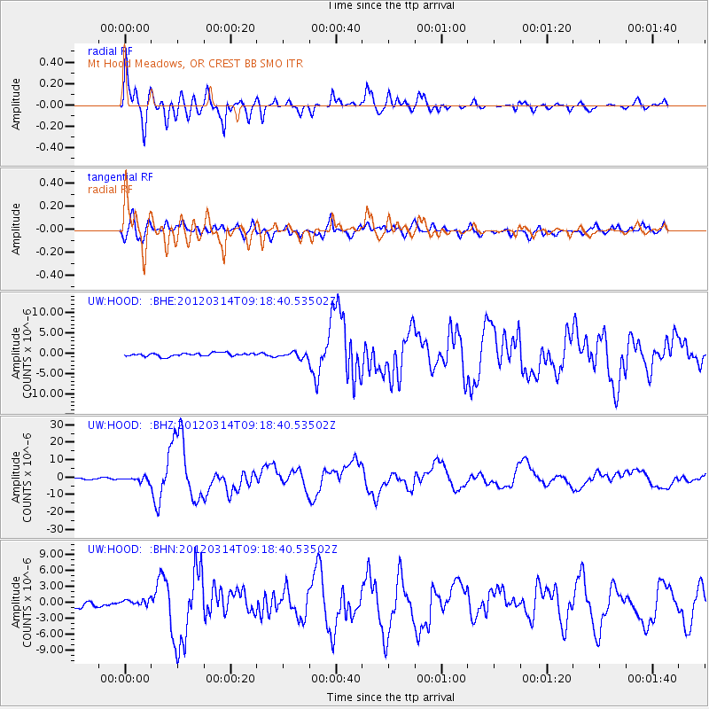
Earthquake location: Off East Coast Of Honshu, Japan
Earthquake latitude/longitude: 40.9/144.9
Earthquake time(UTC): 2012/03/14 (074) 09:08:35 GMT
Earthquake Depth: 12 km
Earthquake Magnitude: 6.7 MB, 6.9 MS, 6.9 MW, 7.0 MW
Earthquake Catalog/Contributor: WHDF/NEIC
Network: UW Pacific Northwest Regional Seismic Network
Station: HOOD Mt Hood Meadows, OR CREST BB SMO
Lat/Lon: 45.32 N/121.65 W
Elevation: 1520 m
Distance: 64.5 deg
Az: 51.281 deg
Baz: 303.023 deg
Ray Param: 0.058871962
Estimated Moho Depth: 29.0 km
Estimated Crust Vp/Vs: 2.10
Assumed Crust Vp: 6.597 km/s
Estimated Crust Vs: 3.149 km/s
Estimated Crust Poisson's Ratio: 0.35
Radial Match: 93.05279 %
Radial Bump: 400
Transverse Match: 82.938515 %
Transverse Bump: 400
SOD ConfigId: 440406
Insert Time: 2012-05-25 23:20:55.994 +0000
GWidth: 2.5
Max Bumps: 400
Tol: 0.001

Signal To Noise

ChannelStoNSTALTA
UW:HOOD: :BHZ:20120314T09:18:40.53502Z2.8911441.3646328E-64.7200444E-7
UW:HOOD: :BHN:20120314T09:18:40.53502Z0.60395095.230817E-78.660997E-7
UW:HOOD: :BHE:20120314T09:18:40.53502Z1.70440546.8071586E-73.9938612E-7
Arrivals
Ps5.0 SECOND
PpPs13 SECOND
PsPs/PpSs18 SECOND