You are here: Home > Network List > TA - USArray Transportable Network (new EarthScope stations) Stations List
> Station Y43A Makayla and Karen, Gunnison, MS, USA > Earthquake Result Viewer
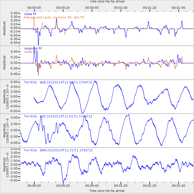
Y43A Makayla and Karen, Gunnison, MS, USA - Earthquake Result Viewer
*The percent match for this event was below the threshold and hence no stack was calculated.
| Earthquake location: |
Off East Coast Of Honshu, Japan |
| Earthquake latitude/longitude: |
40.8/144.8 |
| Earthquake time(UTC): |
2012/03/14 (074) 10:49:24 GMT |
| Earthquake Depth: |
10 km |
| Earthquake Magnitude: |
5.8 MB, 6.1 MW |
| Earthquake Catalog/Contributor: |
WHDF/NEIC |
|
| Network: |
TA USArray Transportable Network (new EarthScope stations) |
| Station: |
Y43A Makayla and Karen, Gunnison, MS, USA |
| Lat/Lon: |
33.91 N/90.93 W |
| Elevation: |
46 m |
|
| Distance: |
89.7 deg |
| Az: |
43.387 deg |
| Baz: |
321.152 deg |
| Ray Param: |
$rayparam |
*The percent match for this event was below the threshold and hence was not used in the summary stack. |
|
| Radial Match: |
86.950096 % |
| Radial Bump: |
400 |
| Transverse Match: |
83.6379 % |
| Transverse Bump: |
374 |
| SOD ConfigId: |
440406 |
| Insert Time: |
2012-05-25 23:42:56.451 +0000 |
| GWidth: |
2.5 |
| Max Bumps: |
400 |
| Tol: |
0.001 |
|
Signal To Noise
| Channel | StoN | STA | LTA |
| TA:Y43A: :BHZ:20120314T11:01:51.174971Z | 1.0383404 | 2.5670336E-6 | 2.4722465E-6 |
| TA:Y43A: :BHN:20120314T11:01:51.174971Z | 0.5564744 | 4.7534806E-7 | 8.542137E-7 |
| TA:Y43A: :BHE:20120314T11:01:51.174971Z | 1.4542872 | 3.9444703E-6 | 2.7123049E-6 |
| Arrivals |
| Ps | |
| PpPs | |
| PsPs/PpSs | |


