
INU Inuyama, Japan - Earthquake Result Viewer
| ||||||||||||||||||
| ||||||||||||||||||
| ||||||||||||||||||
|
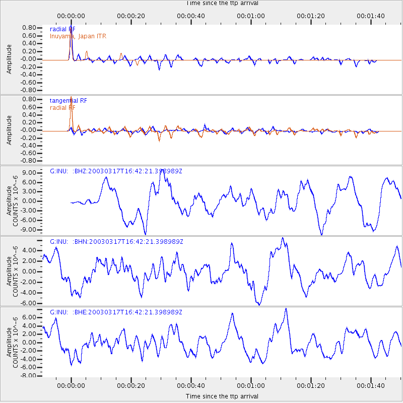
Signal To Noise
| Channel | StoN | STA | LTA |
| G:INU: :BHN:20030317T16:42:21.398989Z | 1.9984574 | 3.6587285E-6 | 1.8307762E-6 |
| G:INU: :BHE:20030317T16:42:21.398989Z | 1.6148275 | 3.6644844E-6 | 2.2692732E-6 |
| G:INU: :BHZ:20030317T16:42:21.398989Z | 1.7334622 | 7.3126207E-6 | 4.218506E-6 |
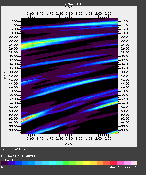
| Arrivals | |
| Ps | 6.4 SECOND |
| PpPs | 23 SECOND |
| PsPs/PpSs | 30 SECOND |

