You are here: Home > Network List > TA - USArray Transportable Network (new EarthScope stations) Stations List
> Station H34A Spellman Lake, Hanley Falls, MN, USA > Earthquake Result Viewer
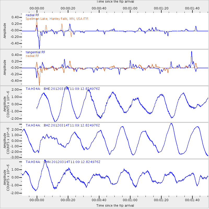
H34A Spellman Lake, Hanley Falls, MN, USA - Earthquake Result Viewer
*The percent match for this event was below the threshold and hence no stack was calculated.
| Earthquake location: |
Off East Coast Of Honshu, Japan |
| Earthquake latitude/longitude: |
40.8/144.8 |
| Earthquake time(UTC): |
2012/03/14 (074) 10:57:40 GMT |
| Earthquake Depth: |
12 km |
| Earthquake Magnitude: |
5.6 MB |
| Earthquake Catalog/Contributor: |
WHDF/NEIC |
|
| Network: |
TA USArray Transportable Network (new EarthScope stations) |
| Station: |
H34A Spellman Lake, Hanley Falls, MN, USA |
| Lat/Lon: |
44.67 N/95.78 W |
| Elevation: |
329 m |
|
| Distance: |
79.1 deg |
| Az: |
39.273 deg |
| Baz: |
317.63 deg |
| Ray Param: |
$rayparam |
*The percent match for this event was below the threshold and hence was not used in the summary stack. |
|
| Radial Match: |
77.54107 % |
| Radial Bump: |
400 |
| Transverse Match: |
75.654175 % |
| Transverse Bump: |
311 |
| SOD ConfigId: |
440406 |
| Insert Time: |
2012-05-26 00:01:12.796 +0000 |
| GWidth: |
2.5 |
| Max Bumps: |
400 |
| Tol: |
0.001 |
|
Signal To Noise
| Channel | StoN | STA | LTA |
| TA:H34A: :BHZ:20120314T11:09:12.824976Z | 1.6096165 | 1.4487124E-6 | 9.0003573E-7 |
| TA:H34A: :BHN:20120314T11:09:12.824976Z | 2.0800238 | 1.203588E-6 | 5.7864145E-7 |
| TA:H34A: :BHE:20120314T11:09:12.824976Z | 0.87880075 | 1.2573377E-6 | 1.4307426E-6 |
| Arrivals |
| Ps | |
| PpPs | |
| PsPs/PpSs | |


