You are here: Home > Network List > TA - USArray Transportable Network (new EarthScope stations) Stations List
> Station M36A Felix, Anita, IA, USA > Earthquake Result Viewer
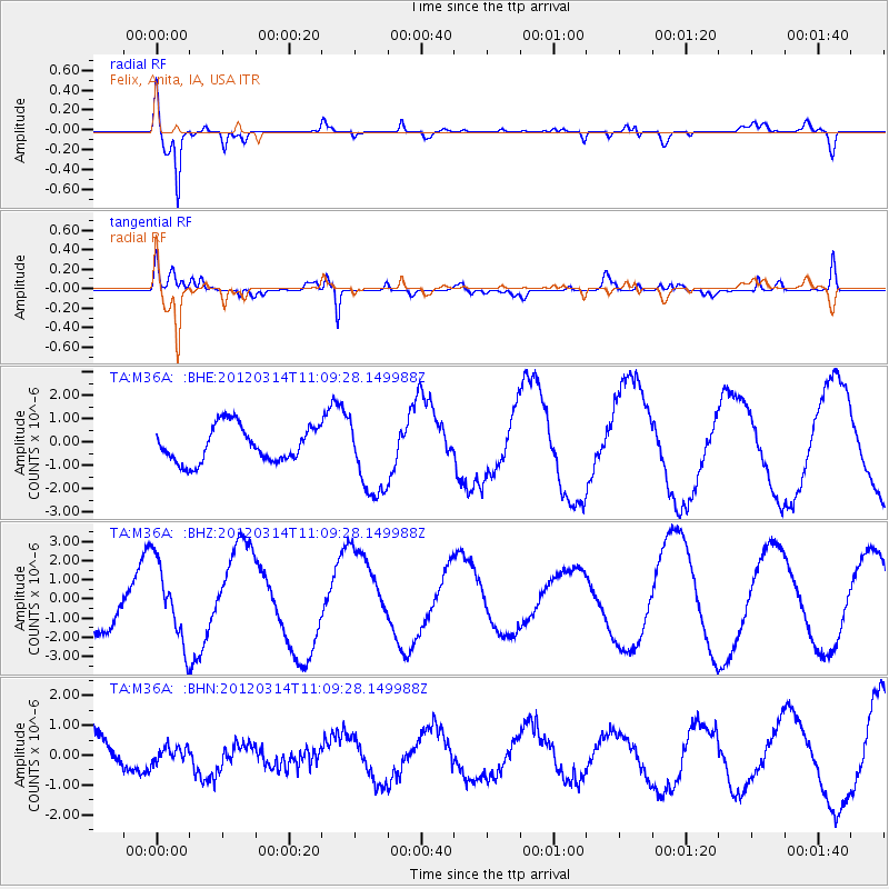
M36A Felix, Anita, IA, USA - Earthquake Result Viewer
*The percent match for this event was below the threshold and hence no stack was calculated.
| Earthquake location: |
Off East Coast Of Honshu, Japan |
| Earthquake latitude/longitude: |
40.8/144.8 |
| Earthquake time(UTC): |
2012/03/14 (074) 10:57:40 GMT |
| Earthquake Depth: |
12 km |
| Earthquake Magnitude: |
5.6 MB |
| Earthquake Catalog/Contributor: |
WHDF/NEIC |
|
| Network: |
TA USArray Transportable Network (new EarthScope stations) |
| Station: |
M36A Felix, Anita, IA, USA |
| Lat/Lon: |
41.45 N/94.80 W |
| Elevation: |
430 m |
|
| Distance: |
82.0 deg |
| Az: |
40.908 deg |
| Baz: |
318.563 deg |
| Ray Param: |
$rayparam |
*The percent match for this event was below the threshold and hence was not used in the summary stack. |
|
| Radial Match: |
85.525894 % |
| Radial Bump: |
400 |
| Transverse Match: |
72.29847 % |
| Transverse Bump: |
400 |
| SOD ConfigId: |
440406 |
| Insert Time: |
2012-05-26 00:02:58.605 +0000 |
| GWidth: |
2.5 |
| Max Bumps: |
400 |
| Tol: |
0.001 |
|
Signal To Noise
| Channel | StoN | STA | LTA |
| TA:M36A: :BHZ:20120314T11:09:28.149988Z | 2.2562616 | 2.0509722E-6 | 9.0901347E-7 |
| TA:M36A: :BHN:20120314T11:09:28.149988Z | 0.40525985 | 2.4983078E-7 | 6.164706E-7 |
| TA:M36A: :BHE:20120314T11:09:28.149988Z | 2.2531052 | 1.7024338E-6 | 7.5559444E-7 |
| Arrivals |
| Ps | |
| PpPs | |
| PsPs/PpSs | |


