You are here: Home > Network List > TA - USArray Transportable Network (new EarthScope stations) Stations List
> Station D41A Chassel, MI, USA > Earthquake Result Viewer
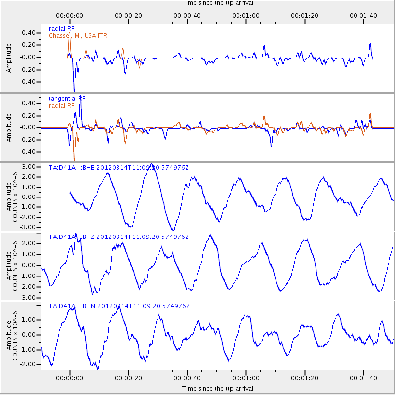
D41A Chassel, MI, USA - Earthquake Result Viewer
*The percent match for this event was below the threshold and hence no stack was calculated.
| Earthquake location: |
Off East Coast Of Honshu, Japan |
| Earthquake latitude/longitude: |
40.8/144.8 |
| Earthquake time(UTC): |
2012/03/14 (074) 10:57:40 GMT |
| Earthquake Depth: |
12 km |
| Earthquake Magnitude: |
5.6 MB |
| Earthquake Catalog/Contributor: |
WHDF/NEIC |
|
| Network: |
TA USArray Transportable Network (new EarthScope stations) |
| Station: |
D41A Chassel, MI, USA |
| Lat/Lon: |
47.06 N/88.57 W |
| Elevation: |
271 m |
|
| Distance: |
80.5 deg |
| Az: |
33.798 deg |
| Baz: |
321.823 deg |
| Ray Param: |
$rayparam |
*The percent match for this event was below the threshold and hence was not used in the summary stack. |
|
| Radial Match: |
74.04774 % |
| Radial Bump: |
400 |
| Transverse Match: |
84.7355 % |
| Transverse Bump: |
400 |
| SOD ConfigId: |
440406 |
| Insert Time: |
2012-05-26 00:06:18.926 +0000 |
| GWidth: |
2.5 |
| Max Bumps: |
400 |
| Tol: |
0.001 |
|
Signal To Noise
| Channel | StoN | STA | LTA |
| TA:D41A: :BHZ:20120314T11:09:20.574976Z | 1.1746075 | 1.8977618E-6 | 1.6156562E-6 |
| TA:D41A: :BHN:20120314T11:09:20.574976Z | 1.7470016 | 1.5769247E-6 | 9.026463E-7 |
| TA:D41A: :BHE:20120314T11:09:20.574976Z | 1.3233863 | 1.884011E-6 | 1.423629E-6 |
| Arrivals |
| Ps | |
| PpPs | |
| PsPs/PpSs | |


