You are here: Home > Network List > TA - USArray Transportable Network (new EarthScope stations) Stations List
> Station N34A Lincoln, NE, USA > Earthquake Result Viewer
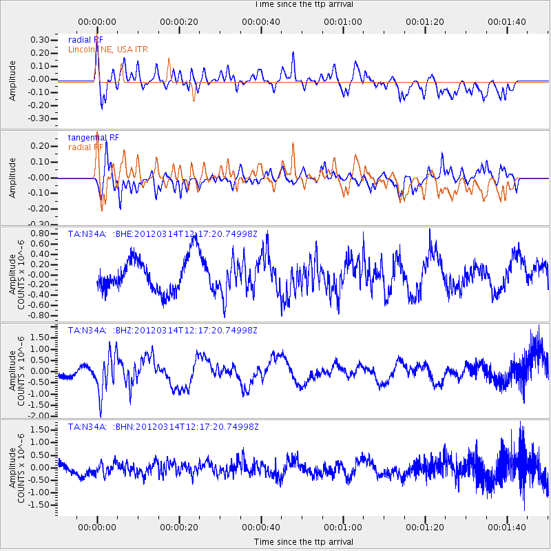
N34A Lincoln, NE, USA - Earthquake Result Viewer
*The percent match for this event was below the threshold and hence no stack was calculated.
| Earthquake location: |
Near East Coast Of Honshu, Japan |
| Earthquake latitude/longitude: |
35.7/140.7 |
| Earthquake time(UTC): |
2012/03/14 (074) 12:05:04 GMT |
| Earthquake Depth: |
10 km |
| Earthquake Magnitude: |
5.7 MB, 5.6 MS, 6.0 MW |
| Earthquake Catalog/Contributor: |
WHDF/NEIC |
|
| Network: |
TA USArray Transportable Network (new EarthScope stations) |
| Station: |
N34A Lincoln, NE, USA |
| Lat/Lon: |
40.84 N/96.50 W |
| Elevation: |
401 m |
|
| Distance: |
87.5 deg |
| Az: |
39.668 deg |
| Baz: |
316.773 deg |
| Ray Param: |
$rayparam |
*The percent match for this event was below the threshold and hence was not used in the summary stack. |
|
| Radial Match: |
57.778652 % |
| Radial Bump: |
400 |
| Transverse Match: |
68.36659 % |
| Transverse Bump: |
400 |
| SOD ConfigId: |
440406 |
| Insert Time: |
2012-05-26 00:29:57.250 +0000 |
| GWidth: |
2.5 |
| Max Bumps: |
400 |
| Tol: |
0.001 |
|
Signal To Noise
| Channel | StoN | STA | LTA |
| TA:N34A: :BHZ:20120314T12:17:20.74998Z | 3.9400659 | 8.448382E-7 | 2.1442236E-7 |
| TA:N34A: :BHN:20120314T12:17:20.74998Z | 0.8955176 | 2.2694422E-7 | 2.534224E-7 |
| TA:N34A: :BHE:20120314T12:17:20.74998Z | 1.0070217 | 3.3627103E-7 | 3.3392632E-7 |
| Arrivals |
| Ps | |
| PpPs | |
| PsPs/PpSs | |


