You are here: Home > Network List > TA - USArray Transportable Network (new EarthScope stations) Stations List
> Station F31A Hecla, SD, USA > Earthquake Result Viewer
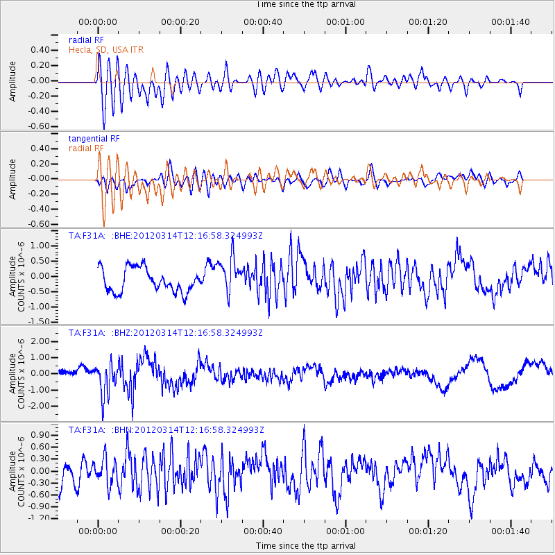
F31A Hecla, SD, USA - Earthquake Result Viewer
*The percent match for this event was below the threshold and hence no stack was calculated.
| Earthquake location: |
Near East Coast Of Honshu, Japan |
| Earthquake latitude/longitude: |
35.7/140.7 |
| Earthquake time(UTC): |
2012/03/14 (074) 12:05:04 GMT |
| Earthquake Depth: |
10 km |
| Earthquake Magnitude: |
5.7 MB, 5.6 MS, 6.0 MW |
| Earthquake Catalog/Contributor: |
WHDF/NEIC |
|
| Network: |
TA USArray Transportable Network (new EarthScope stations) |
| Station: |
F31A Hecla, SD, USA |
| Lat/Lon: |
45.86 N/98.25 W |
| Elevation: |
412 m |
|
| Distance: |
83.0 deg |
| Az: |
37.098 deg |
| Baz: |
315.36 deg |
| Ray Param: |
$rayparam |
*The percent match for this event was below the threshold and hence was not used in the summary stack. |
|
| Radial Match: |
70.25448 % |
| Radial Bump: |
400 |
| Transverse Match: |
58.527203 % |
| Transverse Bump: |
400 |
| SOD ConfigId: |
440406 |
| Insert Time: |
2012-05-26 00:33:36.857 +0000 |
| GWidth: |
2.5 |
| Max Bumps: |
400 |
| Tol: |
0.001 |
|
Signal To Noise
| Channel | StoN | STA | LTA |
| TA:F31A: :BHZ:20120314T12:16:58.324993Z | 3.0090754 | 9.740435E-7 | 3.237019E-7 |
| TA:F31A: :BHN:20120314T12:16:58.324993Z | 1.0540136 | 3.316644E-7 | 3.1466803E-7 |
| TA:F31A: :BHE:20120314T12:16:58.324993Z | 1.5568228 | 5.9561035E-7 | 3.825807E-7 |
| Arrivals |
| Ps | |
| PpPs | |
| PsPs/PpSs | |


