You are here: Home > Network List > TA - USArray Transportable Network (new EarthScope stations) Stations List
> Station G34A Benson, MN, USA > Earthquake Result Viewer
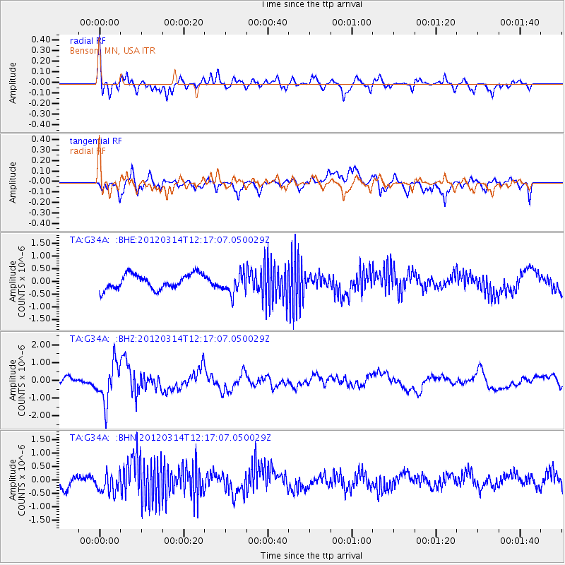
G34A Benson, MN, USA - Earthquake Result Viewer
*The percent match for this event was below the threshold and hence no stack was calculated.
| Earthquake location: |
Near East Coast Of Honshu, Japan |
| Earthquake latitude/longitude: |
35.7/140.7 |
| Earthquake time(UTC): |
2012/03/14 (074) 12:05:04 GMT |
| Earthquake Depth: |
10 km |
| Earthquake Magnitude: |
5.7 MB, 5.6 MS, 6.0 MW |
| Earthquake Catalog/Contributor: |
WHDF/NEIC |
|
| Network: |
TA USArray Transportable Network (new EarthScope stations) |
| Station: |
G34A Benson, MN, USA |
| Lat/Lon: |
45.24 N/95.64 W |
| Elevation: |
316 m |
|
| Distance: |
84.7 deg |
| Az: |
36.193 deg |
| Baz: |
317.123 deg |
| Ray Param: |
$rayparam |
*The percent match for this event was below the threshold and hence was not used in the summary stack. |
|
| Radial Match: |
59.146725 % |
| Radial Bump: |
400 |
| Transverse Match: |
66.12001 % |
| Transverse Bump: |
400 |
| SOD ConfigId: |
440406 |
| Insert Time: |
2012-05-26 00:33:52.580 +0000 |
| GWidth: |
2.5 |
| Max Bumps: |
400 |
| Tol: |
0.001 |
|
Signal To Noise
| Channel | StoN | STA | LTA |
| TA:G34A: :BHZ:20120314T12:17:07.050029Z | 3.4864953 | 1.1335983E-6 | 3.2513978E-7 |
| TA:G34A: :BHN:20120314T12:17:07.050029Z | 1.9255192 | 3.7387417E-7 | 1.9416797E-7 |
| TA:G34A: :BHE:20120314T12:17:07.050029Z | 1.4271191 | 4.1681204E-7 | 2.9206535E-7 |
| Arrivals |
| Ps | |
| PpPs | |
| PsPs/PpSs | |


