
INU Inuyama, Japan - Earthquake Result Viewer
| ||||||||||||||||||
| ||||||||||||||||||
| ||||||||||||||||||
|
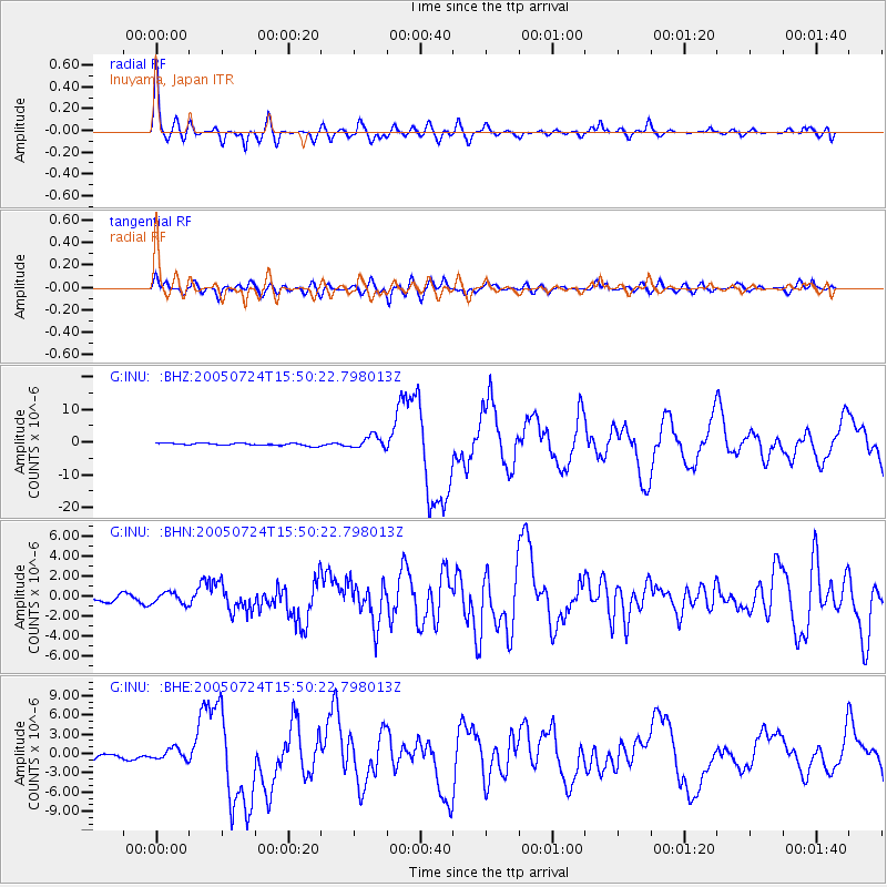
Signal To Noise
| Channel | StoN | STA | LTA |
| G:INU: :BHN:20050724T15:50:22.798013Z | 2.1777108 | 5.5956565E-7 | 2.5695132E-7 |
| G:INU: :BHE:20050724T15:50:22.798013Z | 2.758447 | 8.7950053E-7 | 3.1883903E-7 |
| G:INU: :BHZ:20050724T15:50:22.798013Z | 5.2772737 | 1.9287365E-6 | 3.6547974E-7 |
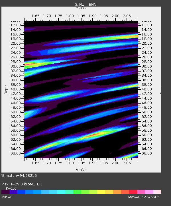
| Arrivals | |
| Ps | 2.9 SECOND |
| PpPs | 11 SECOND |
| PsPs/PpSs | 14 SECOND |

