You are here: Home > Network List > TA - USArray Transportable Network (new EarthScope stations) Stations List
> Station J04D Umpqua National Forest, Toketee, OR, USA > Earthquake Result Viewer
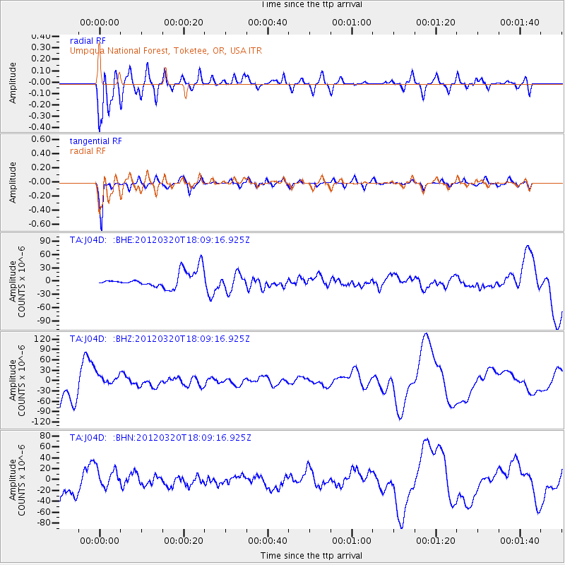
J04D Umpqua National Forest, Toketee, OR, USA - Earthquake Result Viewer
*The percent match for this event was below the threshold and hence no stack was calculated.
| Earthquake location: |
Irian Jaya, Indonesia |
| Earthquake latitude/longitude: |
-3.8/140.3 |
| Earthquake time(UTC): |
2012/03/20 (080) 17:56:18 GMT |
| Earthquake Depth: |
66 km |
| Earthquake Magnitude: |
6.2 MB, 6.1 MW, 6.2 MW |
| Earthquake Catalog/Contributor: |
WHDF/NEIC |
|
| Network: |
TA USArray Transportable Network (new EarthScope stations) |
| Station: |
J04D Umpqua National Forest, Toketee, OR, USA |
| Lat/Lon: |
43.24 N/122.11 W |
| Elevation: |
1948 m |
|
| Distance: |
98.2 deg |
| Az: |
47.03 deg |
| Baz: |
272.438 deg |
| Ray Param: |
$rayparam |
*The percent match for this event was below the threshold and hence was not used in the summary stack. |
|
| Radial Match: |
86.88933 % |
| Radial Bump: |
400 |
| Transverse Match: |
89.05002 % |
| Transverse Bump: |
307 |
| SOD ConfigId: |
440406 |
| Insert Time: |
2012-06-03 02:22:22.196 +0000 |
| GWidth: |
2.5 |
| Max Bumps: |
400 |
| Tol: |
0.001 |
|
Signal To Noise
| Channel | StoN | STA | LTA |
| TA:J04D: :BHZ:20120320T18:09:16.925Z | 0.5611469 | 2.0762058E-5 | 3.699933E-5 |
| TA:J04D: :BHN:20120320T18:09:16.925Z | 1.1028998 | 1.8140398E-5 | 1.644791E-5 |
| TA:J04D: :BHE:20120320T18:09:16.925Z | 1.1057115 | 1.9486186E-5 | 1.7623212E-5 |
| Arrivals |
| Ps | |
| PpPs | |
| PsPs/PpSs | |


