INK INUVIK, NT, CANADA.ANADA - Earthquake Result Viewer
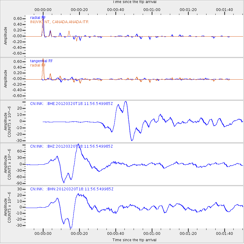
Earthquake location: Near Coast Of Guerrero, Mexico
Earthquake latitude/longitude: 16.5/-98.2
Earthquake time(UTC): 2012/03/20 (080) 18:02:47 GMT
Earthquake Depth: 20 km
Earthquake Magnitude: 6.6 MB, 7.6 MS, 7.4 MW, 7.4 MW
Earthquake Catalog/Contributor: WHDF/NEIC
Network: CN Canadian National Seismograph Network
Station: INK INUVIK, NT, CANADA.ANADA
Lat/Lon: 68.31 N/133.52 W
Elevation: 40 m
Distance: 56.4 deg
Az: 345.061 deg
Baz: 138.3 deg
Ray Param: 0.064128496
Estimated Moho Depth: 41.25 km
Estimated Crust Vp/Vs: 1.60
Assumed Crust Vp: 6.171 km/s
Estimated Crust Vs: 3.857 km/s
Estimated Crust Poisson's Ratio: 0.18
Radial Match: 99.2307 %
Radial Bump: 147
Transverse Match: 91.28713 %
Transverse Bump: 400
SOD ConfigId: 440406
Insert Time: 2012-06-03 02:28:32.190 +0000
GWidth: 2.5
Max Bumps: 400
Tol: 0.001

Signal To Noise

ChannelStoNSTALTA
CN:INK: :BHZ:20120320T18:11:56.549985Z23.7496781.1061093E-54.6573652E-7
CN:INK: :BHN:20120320T18:11:56.549985Z20.2839684.0976024E-62.0201188E-7
CN:INK: :BHE:20120320T18:11:56.549985Z15.5717624.3209116E-62.774838E-7
Arrivals
Ps4.2 SECOND
PpPs17 SECOND
PsPs/PpSs21 SECOND