
YKW3 - Earthquake Result Viewer
| ||||||||||||||||||
| ||||||||||||||||||
| ||||||||||||||||||
|
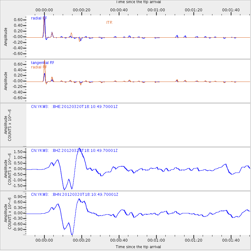
Signal To Noise
| Channel | StoN | STA | LTA |
| CN:YKW3: :BHZ:20120320T18:10:49.70001Z | 26.017206 | 3.133669E-7 | 1.2044603E-8 |
| CN:YKW3: :BHN:20120320T18:10:49.70001Z | 42.494114 | 1.8062792E-7 | 4.2506576E-9 |
| $trig.getChannelId() | $trig.getValue() | $trig.getSTA() | $trig.getLTA() |
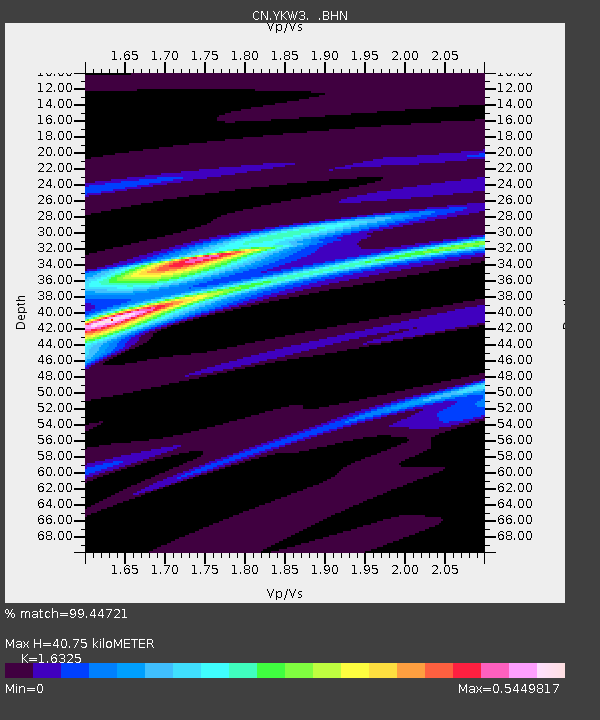
| Arrivals | |
| Ps | 4.3 SECOND |
| PpPs | 16 SECOND |
| PsPs/PpSs | 20 SECOND |

